ZCZC MIATWOEP ALL
TTAA00 KNHC DDHHMM
TROPICAL WEATHER OUTLOOK
NWS NATIONAL HURRICANE CENTER MIAMI FL
500 AM PDT THU SEP 22 2016
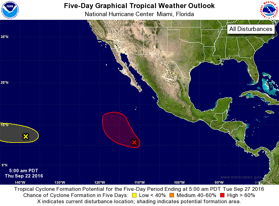
For the eastern North Pacific...east of 140 degrees west longitude:
1. A large area of disturbed weather located about 850 miles south of
the southern tip of the Baja California peninsula is associated with
a broad area of low pressure. The associated shower and
thunderstorm activity has increased since yesterday, and conditions
appear favorable for a tropical depression to form during the next
couple of days. This disturbance is forecast to move toward the
northwest and then northward during the next several days.
* Formation chance through 48 hours...high...70 percent
* Formation chance through 5 days...high...90 percent
2. Showers and thunderstorms associated with a weak area of low
pressure located about 1200 miles east-southeast of the Big Island
of Hawaii remain poorly organized. Any development of this system
is expected to be slow to occur while it moves slowly westward
during the next few days.
* Formation chance through 48 hours...low...10 percent
* Formation chance through 5 days...low...20 percent
Forecaster Brennan