ZCZC MIATWOEP ALL
TTAA00 KNHC DDHHMM
TROPICAL WEATHER OUTLOOK
NWS NATIONAL HURRICANE CENTER MIAMI FL
500 AM PDT WED SEP 21 2016
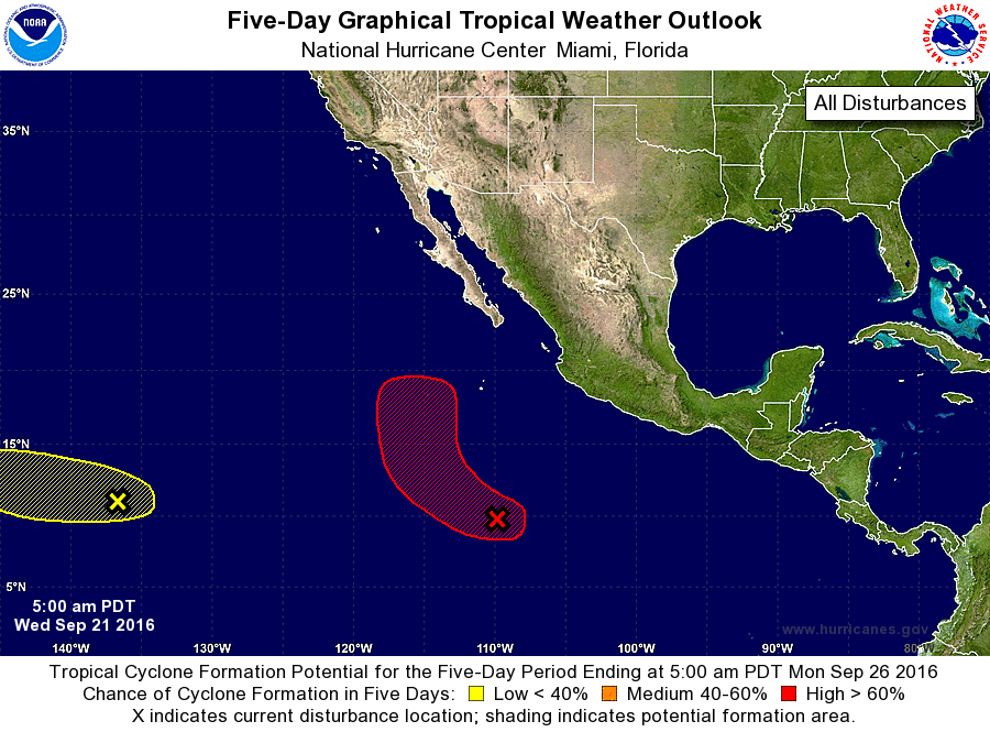
For the eastern North Pacific...east of 140 degrees west longitude:
1. A broad area of low pressure located about 700 miles south-southwest
of Manzanillo, Mexico, is producing a large area of disorganized
cloudiness and thunderstorms. Environmental conditions are expected
to be conducive for gradual development during the next several
days, and a tropical depression is likely to form later this week or
this weekend. This system is forecast to move westward to west-
northwestward at around 10 mph for the next couple of days and then
turn northward by the weekend.
* Formation chance through 48 hours...medium...40 percent
* Formation chance through 5 days...high...80 percent
2. A weak area of low pressure located about 1350 miles east-southeast
of the Big Island of Hawaii continues to produce disorganized shower
and thunderstorm activity. Any development of this system should be
slow to occur while it moves slowly westward during the next few
days.
* Formation chance through 48 hours...low...10 percent
* Formation chance through 5 days...low...20 percent
Forecaster Brennan