ZCZC MIATWOEP ALL
TTAA00 KNHC DDHHMM
TROPICAL WEATHER OUTLOOK
NWS NATIONAL HURRICANE CENTER MIAMI FL
1100 PM PDT MON SEP 19 2016
For the eastern North Pacific...east of 140 degrees west longitude:
The National Hurricane Center is issuing advisories on recently
downgraded Tropical Storm Paine, located a few hundred miles west of
the Baja California peninsula.
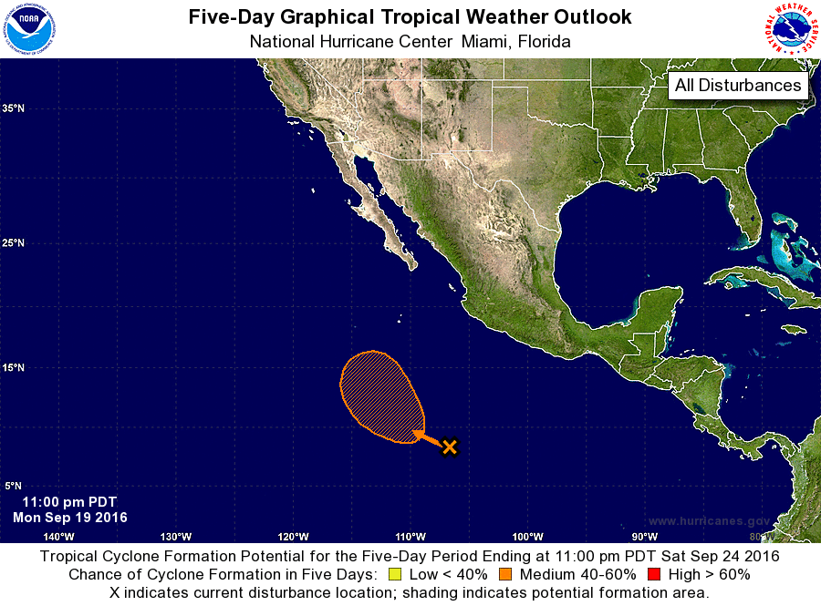
1. A broad area of low pressure associated with a tropical wave has
formed several hundred miles south-southwest of Manzanillo, Mexico.
Although cloudiness and showers associated with this system are
currently disorganized, environmental conditions are conducive
for gradual development during the next several days. The low is
expected to turn northwestward and then northward by later this
week.
* Formation chance through 48 hours...low...20 percent
* Formation chance through 5 days...medium...50 percent
Forecaster Kimberlain