ZCZC MIATWOEP ALL
TTAA00 KNHC DDHHMM
TROPICAL WEATHER OUTLOOK
NWS NATIONAL HURRICANE CENTER MIAMI FL
1100 AM PDT FRI SEP 16 2016
For the eastern North Pacific...east of 140 degrees west longitude:
The National Hurricane Center is issuing advisories on Tropical
Storm Orlene, located well west of the southern tip of the Baja
California peninsula.
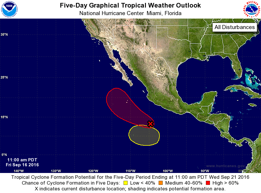
1. Showers and thunderstorms continue to show signs of organization in
association with a broad area of low pressure located several
hundred miles southwest of Acapulco, Mexico. This low is expected
to become a tropical depression this weekend while it moves
west-northwestward to northwestward at 10 mph, parallel to but
a few hundred miles offshore of the coast of Mexico.
*Formation chance through 48 hours...high...80 percent
*Formation chance through 5 days...high...90 percent
2. An area of low pressure could form early next week several hundred
miles southwest of Mexico. Some gradual development is possible by
midweek while the system moves slowly west-northwestward.
*Formation chance through 48 hours...low...near 0 percent
*Formation chance through 5 days...low...20 percent
Forecaster Blake