ZCZC MIATWOEP ALL
TTAA00 KNHC DDHHMM
TROPICAL WEATHER OUTLOOK
NWS NATIONAL HURRICANE CENTER MIAMI FL
500 PM PDT THU SEP 15 2016
For the eastern North Pacific...east of 140 degrees west longitude:
The National Hurricane Center is issuing advisories on Hurricane
Orlene, located several hundred miles west-southwest of the southern
tip of the Baja California peninsula.
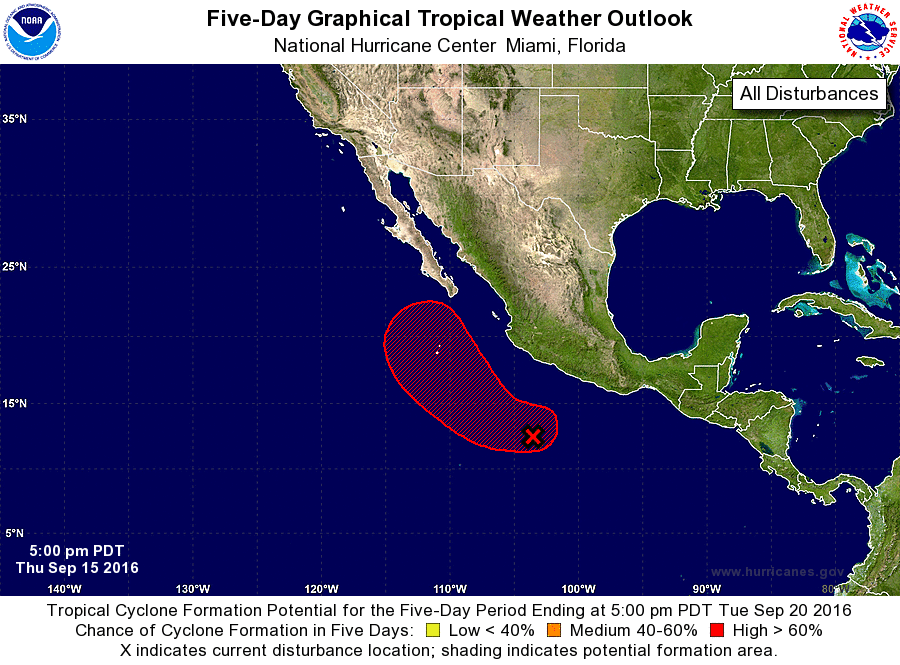
1. A broad area of low pressure, centered several hundred miles
southwest of Acapulco, Mexico, is producing a large area of showers
and thunderstorms. The disturbance is gradually becoming better
organized and, since environmental conditions are becoming more
conducive for development, a tropical depression is likely to form
over the weekend while the low moves west-northwestward to
northwestward, parallel to the coast of Mexico.
*Formation chance through 48 hours...medium...50 percent
*Formation chance through 5 days...high...90 percent
Forecaster Stewart