ZCZC MIATWOEP ALL
TTAA00 KNHC DDHHMM
TROPICAL WEATHER OUTLOOK
NWS NATIONAL HURRICANE CENTER MIAMI FL
500 PM PDT WED SEP 14 2016
For the eastern North Pacific...east of 140 degrees west longitude:
The National Hurricane Center is issuing advisories on Hurricane
Orlene, located several hundred miles west-southwest of the southern
tip of the Baja California peninsula.
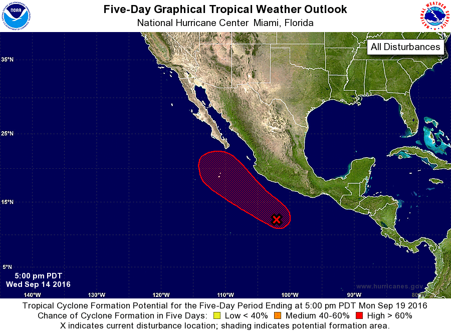
1. A nearly stationary low pressure system located a few hundred miles
south-southwest of Acapulco, Mexico, continues to produce a small
area of disorganized shower activity. Environmental conditions are
expected to gradually become more conducive for development, and a
tropical depression could form this weekend or early next week while
the low begins moving west-northwestward to northwestward, parallel
to the coast of Mexico.
*Formation chance through 48 hours...low...20 percent
*Formation chance through 5 days...high...70 percent
Forecaster Stewart