ZCZC MIATWOEP ALL
TTAA00 KNHC DDHHMM
TROPICAL WEATHER OUTLOOK
NWS NATIONAL HURRICANE CENTER MIAMI FL
500 PM PDT SAT SEP 10 2016
For the eastern North Pacific...east of 140 degrees west longitude:
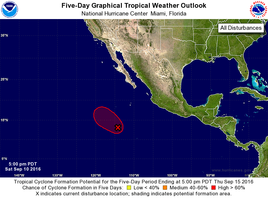
1. Satellite data indicate that the area of low pressure located about
730 miles south-southwest of the southern tip of the Baja California
peninsula has become better defined since yesterday. Environmental
conditions are favorable for further development, and only a
small increase in the low's associated shower and thunderstorm
activity would result in the formation of a tropical depression
tonight or tomorrow while it moves northwestward or west-
northwestward at 10 to 15 mph.
* Formation chance through 48 hours...high...near 100 percent
* Formation chance through 5 days...high...near 100 percent
Forecaster Blake