ZCZC MIATWOEP ALL
TTAA00 KNHC DDHHMM
TROPICAL WEATHER OUTLOOK
NWS NATIONAL HURRICANE CENTER MIAMI FL
1100 PM PDT THU SEP 8 2016
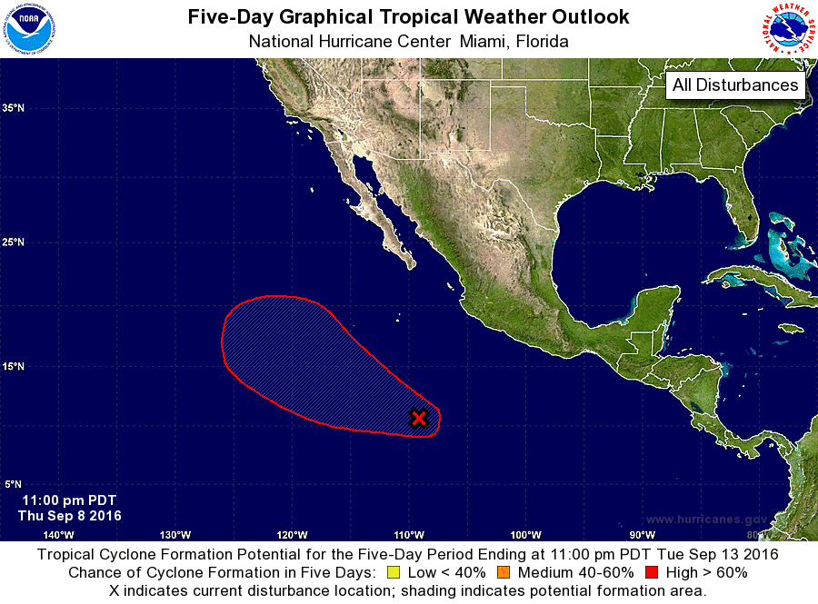
For the eastern North Pacific...east of 140 degrees west longitude:
1. Shower and thunderstorm activity has begun to show some signs of
organization in association with a broad area of low pressure
located about 850 miles south of the southern tip of the Baja
California peninsula. Environmental conditions are expected to be
conducive for gradual development during the next several days, and
a tropical depression is likely to form late this weekend or early
next week while the low moves west-northwestward and then
northwestward at 10 to 15 mph.
* Formation chance through 48 hours...medium...50 percent
* Formation chance through 5 days...high...80 percent
Forecaster Brennan