ZCZC MIATWOEP ALL
TTAA00 KNHC DDHHMM
TROPICAL WEATHER OUTLOOK
NWS NATIONAL HURRICANE CENTER MIAMI FL
500 PM PDT WED SEP 7 2016
For the eastern North Pacific...east of 140 degrees west longitude:
The National Hurricane Center has issued its final advisory on
Newton, which has become a post-tropical remnant low over
southeastern Arizona. Future advisories on this system will be
issued by the Weather Prediction Center beginning at 8 PM PDT.
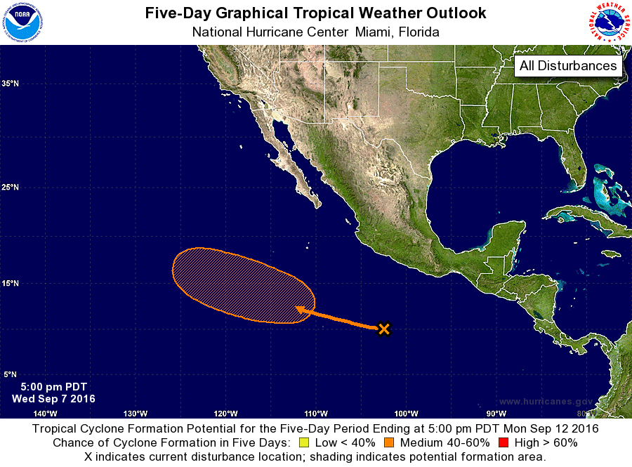
1. A tropical wave located well south-southwest of Acapulco, Mexico, is
producing a large area of disorganized showers and thunderstorms. A
low pressure system is expected to form from this wave in a couple
of days well south-southwest of the southern tip of the Baja
California peninsula. Slow development of this system is possible,
and a tropical depression could form over the weekend or early next
week while the low moves west-northwestward.
* Formation chance through 48 hours...low...near 0 percent
* Formation chance through 5 days...medium...60 percent
Future information on Newton can be found in Public Advisories
issued by the Weather Prediction Center beginning at 8 PM PDT, under
AWIPS header TCPEP5, WMO header WTPZ35 KWNH, and on the web at
http://www.wpc.ncep.noaa.gov.
Forecaster Brown