ZCZC MIATWOEP ALL
TTAA00 KNHC DDHHMM
TROPICAL WEATHER OUTLOOK
NWS NATIONAL HURRICANE CENTER MIAMI FL
1100 PM PDT WED AUG 31 2016
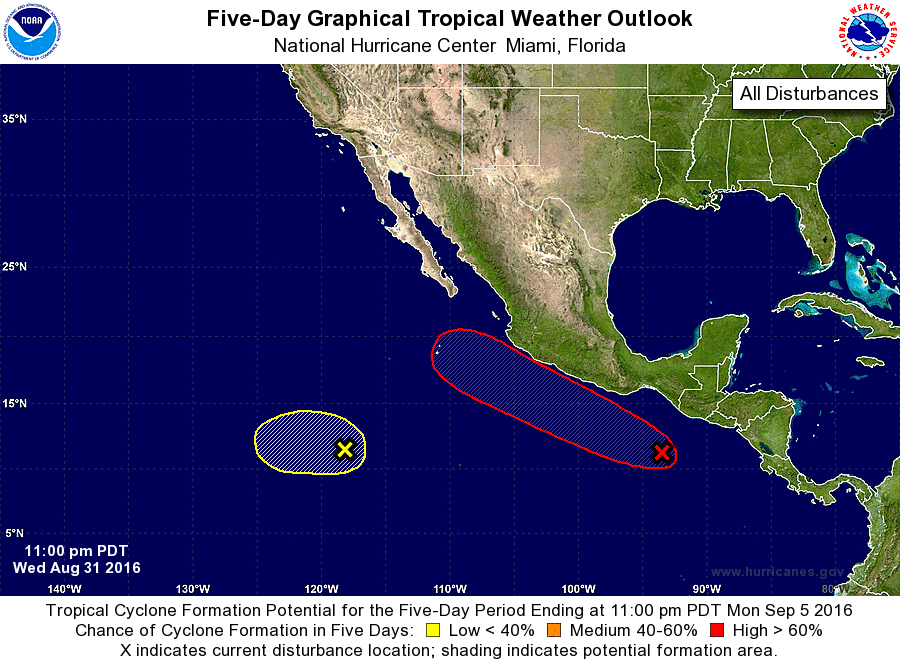
For the eastern North Pacific...east of 140 degrees west longitude:
1. An area of disturbed weather is located about 500 miles southeast
of Acapulco, Mexico. Environmental conditions are expected to
become conducive for development of this system, and a tropical
depression is likely to form over the weekend while the low moves
west-northwestward or northwestward near the coast of Mexico.
* Formation chance through 48 hours...low...30 percent
* Formation chance through 5 days...high...80 percent
2. A weak area of low pressure is located about 1000 miles
south-southwest of the southern tip of the Baja California
peninsula. This system is expected to drift westward during the next
few days, and any development should be slow to occur due to strong
upper-level winds.
* Formation chance through 48 hours...low...10 percent
* Formation chance through 5 days...low...20 percent
Forecaster Cangialosi