ZCZC MIATWOEP ALL
TTAA00 KNHC DDHHMM
TROPICAL WEATHER OUTLOOK
NWS NATIONAL HURRICANE CENTER MIAMI FL
500 PM PDT SUN AUG 28 2016
For the eastern North Pacific...east of 140 degrees west longitude:
The National Hurricane Center is issuing advisories on Hurricane
Lester, located about 1000 miles west-southwest of the southern
tip of the Baja California peninsula.
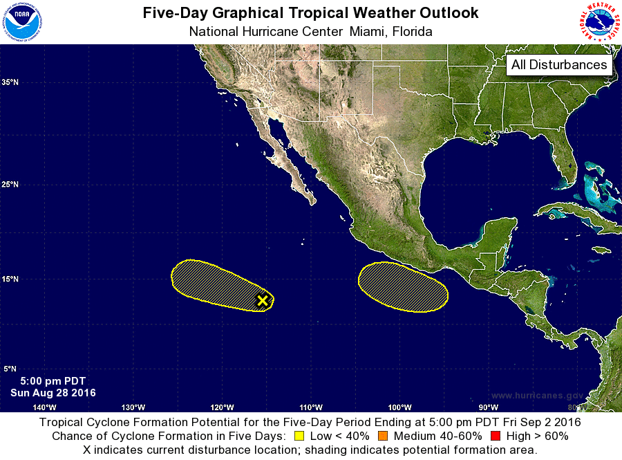
1. A large area of cloudiness and disorganized showers is located
several hundred miles south-southwest of the southern tip of the
Baja California peninsula. Development, if any, of this system is
expected to be slow to occur while it moves slowly toward the
west-northwest during the next few days.
* Formation chance through 48 hours...low...10 percent
* Formation chance through 5 days...low...20 percent
2. An area of low pressure is expected to form later this week a few
hundred miles south or southeast of Acapulco, Mexico. Environmental
conditions appear conducive for slow development of this system
while it moves generally west-northwestward.
* Formation chance through 48 hours...low...near 0 percent
* Formation chance through 5 days...low...20 percent
Forecaster Cangialosi