ZCZC MIATWOEP ALL
TTAA00 KNHC DDHHMM
TROPICAL WEATHER OUTLOOK
NWS NATIONAL HURRICANE CENTER MIAMI FL
500 AM PDT THU AUG 25 2016
For the eastern North Pacific...east of 140 degrees west longitude:
The National Hurricane Center is issuing advisories on recently
upgraded Tropical Storm Lester, located about 500 miles south-
southwest of the southern tip of the Baja California Peninsula.
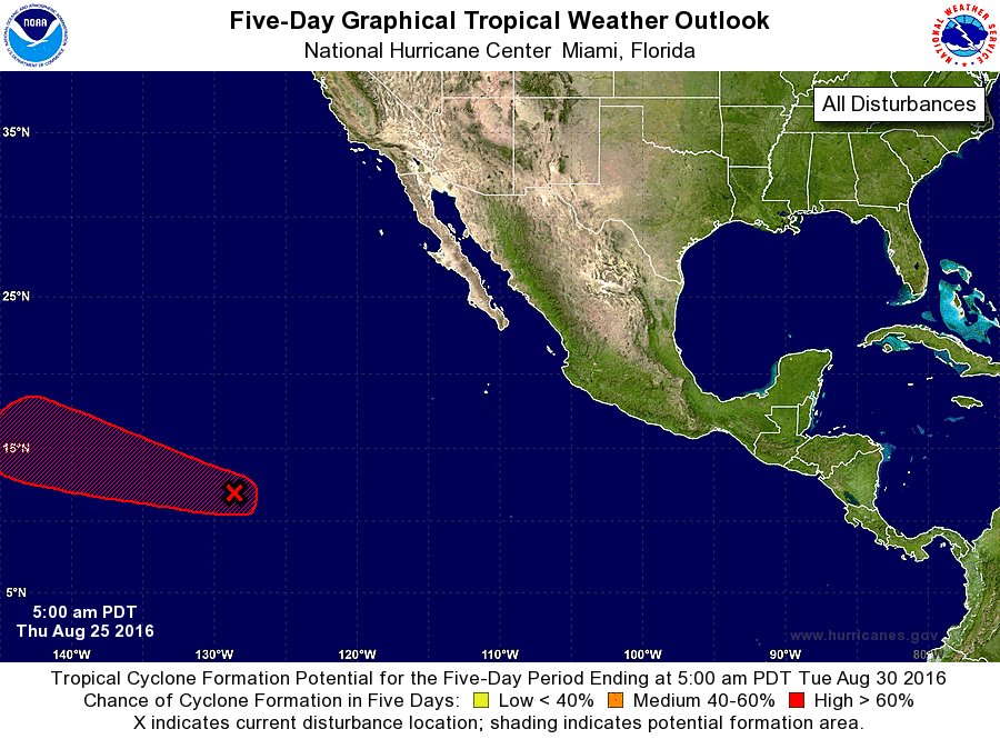
1. Showers and thunderstorms associated with an area of low pressure
located about 1500 miles west-southwest of the southern tip of the
Baja California peninsula have increased a little during the past
24 hours. Environmental conditions are expected to be conducive for
gradual development, and a tropical depression is likely to form by
this weekend while the low moves westward or west-northwestward at
15 to 20 mph.
* Formation chance through 48 hours...medium...50 percent
* Formation chance through 5 days...high...80 percent
Public Advisories on Lester are issued under WMO header WTPZ33 KNHC
and under AWIPS header MIATCPEP3. Forecast/Advisories on Lester are
issued under WMO header WTPZ23 KNHC and under AWIPS header
MIATCMEP3.
Forecaster Brennan