ZCZC MIATWOEP ALL
TTAA00 KNHC DDHHMM
TROPICAL WEATHER OUTLOOK
NWS NATIONAL HURRICANE CENTER MIAMI FL
500 PM PDT SUN AUG 14 2016
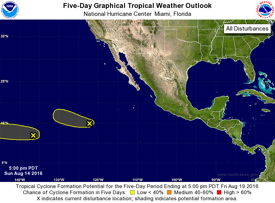
For the eastern North Pacific...east of 140 degrees west longitude:
1. An area of disturbed weather is located about 1300 miles
east-southeast of the Hawaiian Islands. This system is moving
westward at about 10 mph, and is expected to move into the Central
Pacific basin on Monday. Development, if any, of this system should
be slow to occur during the next several days.
* Formation chance through 48 hours...low...10 percent
* Formation chance through 5 days...low...20 percent
2. A trough of low pressure located a little more than 1000 miles
southwest of the southern tip of the Baja California peninsula is
producing an area of showers and thunderstorms. Environmental
conditions are expected to become less conducive for development of
this system during the next couple of days while it moves generally
west-northwestward.
* Formation chance through 48 hours...low...10 percent
* Formation chance through 5 days...low...10 percent
Forecaster Cangialosi