ZCZC MIATWOEP ALL
TTAA00 KNHC DDHHMM
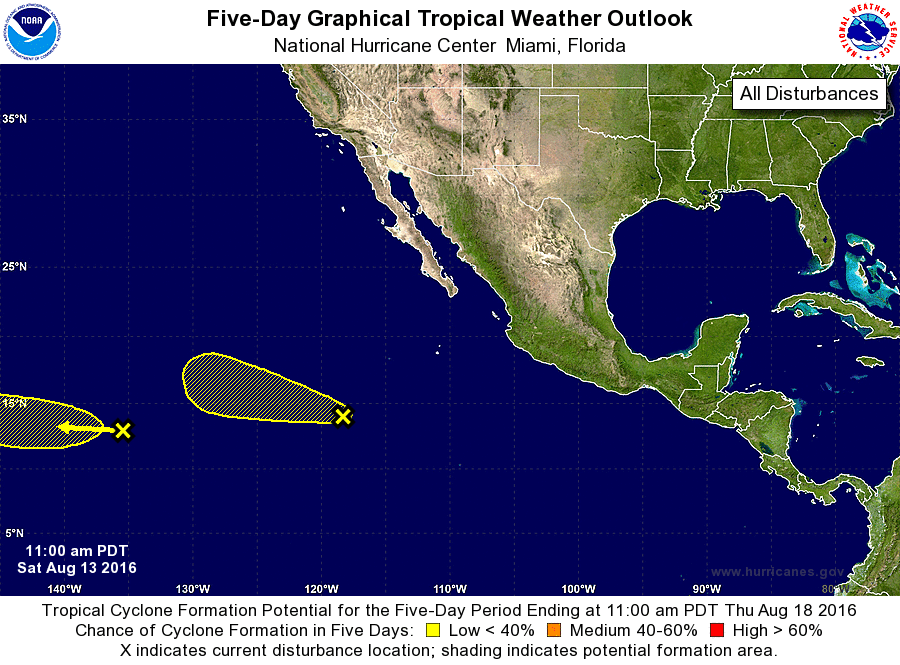
TROPICAL WEATHER OUTLOOK
NWS NATIONAL HURRICANE CENTER MIAMI FL
1100 AM PDT SAT AUG 13 2016
For the eastern North Pacific...east of 140 degrees west longitude:
1. An area of disturbed weather is located about 1350 miles east-
southeast of the Hawaiian Islands. A low pressure area could form
within this disturbance during the next day or two, but any further
development should be slow to occur. This system is forecast to
move generally westward into the Central Pacific basin within a
couple of days.
* Formation chance through 48 hours...low...near 0 percent
* Formation chance through 5 days...low...10 percent
2. Another area of disturbed weather located about 800 miles southwest
of the southern tip of the Baja California peninsula is showing some
signs of organization. However, environmental conditions are
expected to remain only marginally conducive for any additional
development while this system moves generally west-northwestward.
* Formation chance through 48 hours...low...10 percent
* Formation chance through 5 days...low...10 percent
Forecaster Kimberlain