ZCZC MIATWOEP ALL
TTAA00 KNHC DDHHMM
TROPICAL WEATHER OUTLOOK
NWS NATIONAL HURRICANE CENTER MIAMI FL
1100 PM PDT SAT AUG 6 2016
For the eastern North Pacific...east of 140 degrees west longitude:
The National Hurricane Center is issuing advisories on Tropical
Storm Ivette, located about 1250 miles east of the Hawaiian Islands.
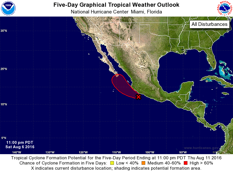
1. Showers and thunderstorms associated with a low pressure area about
150 miles south-southeast of Manzanillo, Mexico, continue to show
signs of organization. Satellite data suggest that the circulation
is becoming better defined and a tropical depression or storm is
likely to form tonight or Sunday. This system is expected to move
west-northwestward to northwestward and pass near the southwestern
coast of Mexico on Sunday and approach the southern Baja California
peninsula on Monday. Interests in these areas should monitor the
progress of this system. Regardless of development, locally heavy
rainfall and gusty winds are likely along the southwestern coast of
Mexico through Sunday night. These rains could cause
life-threatening flash floods and mudslides.
* Formation chance through 48 hours...high...90 percent
* Formation chance through 5 days...high...90 percent
Forecaster Brown