ZCZC MIATWOEP ALL
TTAA00 KNHC DDHHMM
TROPICAL WEATHER OUTLOOK
NWS NATIONAL HURRICANE CENTER MIAMI FL
500 AM PDT FRI AUG 5 2016
For the eastern North Pacific...east of 140 degrees west longitude:
The National Hurricane Center is issuing advisories on Tropical
Storm Ivette, located about 1400 miles west-southwest of the
southern tip of the Baja California peninsula.
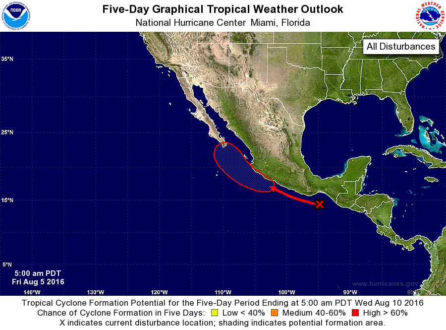
1. An area of cloudiness and disorganized thunderstorms is located
near the Gulf of Tehuantepec. This disturbance is expected
to move west-northwestward and merge with the remnants of Atlantic
Tropical Storm Earl, and an area of low pressure is forecast to form
near the southwestern coast of Mexico over the weekend. Conditions
appear conducive for development, and a tropical depression is
likely to form early next week while the low moves northwestward
toward the Baja California peninsula.
* Formation chance through 48 hours...medium...40 percent
* Formation chance through 5 days...high...70 percent
Forecaster Berg