ZCZC MIATWOEP ALL CCB
TTAA00 KNHC DDHHMM
TROPICAL WEATHER OUTLOOK...CORRECTED
NWS NATIONAL HURRICANE CENTER MIAMI FL
1100 AM PDT TUE AUG 2 2016
Corrected for missing reference location
For the eastern North Pacific...east of 140 degrees west longitude:
The National Hurricane Center is issuing advisories on Tropical
Storm Howard, located almost 1300 miles west of the southern tip of
the Baja California peninsula.
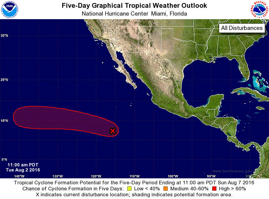
1. Shower and thunderstorm activity associated with a low pressure
system centered about 800 miles south-southwest of the southern
tip of the Baja California peninsula has become much better
organized during the morning hours, and it appears that a tropical
depression could be forming. Environmental conditions are conducive
for additional development, and advisories could be initiated on
this system later today or tonight while it moves west-northwestward
at about 15 mph.
* Formation chance through 48 hours...high...80 percent
* Formation chance through 5 days...high...90 percent
Forecaster Berg