ZCZC MIATWOEP ALL
TTAA00 KNHC DDHHMM
TROPICAL WEATHER OUTLOOK
NWS NATIONAL HURRICANE CENTER MIAMI FL
500 PM PDT SUN JUL 31 2016
For the eastern North Pacific...east of 140 degrees west longitude:
The National Hurricane Center is issuing advisories on Tropical
Depression Nine-E, located about 900 miles west-southwest of the
southern tip of the Baja California peninsula.
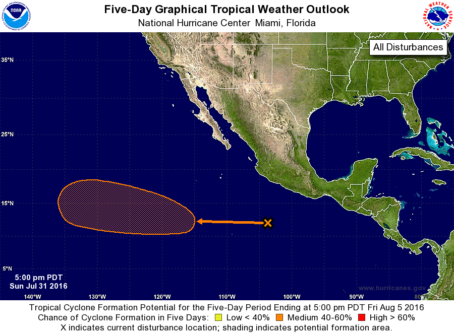
1. A large area of disorganized showers and thunderstorms located
about 500 miles south of Manzanillo, Mexico is associated
with a tropical wave. Environmental conditions are expected to be
conducive for gradual development of this system later this week
while it moves west-northwestward at around 15 mph.
* Formation chance through 48 hours...low...near 0 percent
* Formation chance through 5 days...medium...60 percent
Public Advisories on Tropical Depression Nine-E are issued under WMO
header WTPZ34 KNHC and under AWIPS header MIATCPEP4.
Forecast/Advisories on Tropical Depression Nine-E are issued under
WMO header WTPZ24 KNHC and under AWIPS header MIATCMEP4.
Forecaster Cangialosi