ZCZC MIATWOEP ALL
TTAA00 KNHC DDHHMM
TROPICAL WEATHER OUTLOOK
NWS NATIONAL HURRICANE CENTER MIAMI FL
500 PM PDT SAT JUL 30 2016
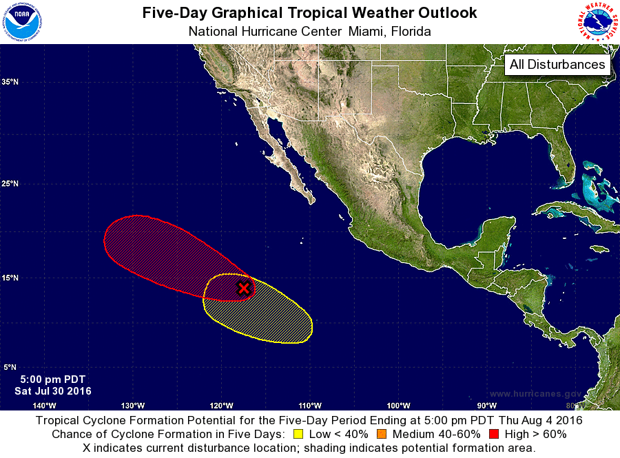
For the eastern North Pacific...east of 140 degrees west longitude:
1. Shower activity associated with a low pressure system centered about
800 miles southwest of the southern tip of the Baja California
peninsula is gradually increasing and becoming slightly better
organized. Environmental conditions are conducive for development,
and a tropical depression is likely to form within the next day
late or two while the low moves toward the west-northwest at 10 to
15 mph. After that time, conditions are expected to be less
conducive for development.
* Formation chance through 48 hours...high...70 percent
* Formation chance through 5 days...high...90 percent
2. A trough of low pressure is expected to form in a couple of days
several hundred miles south of Mexico. Some development of this
system is possible by the middle of next week while it moves
west-northwestward away from the coast of Mexico.
* Formation chance through 48 hours...low...near 0 percent
* Formation chance through 5 days...low...30 percent
Forecaster Avila