ZCZC MIATWOEP ALL
TTAA00 KNHC DDHHMM
TROPICAL WEATHER OUTLOOK
NWS NATIONAL HURRICANE CENTER MIAMI FL
500 PM PDT FRI JUL 29 2016
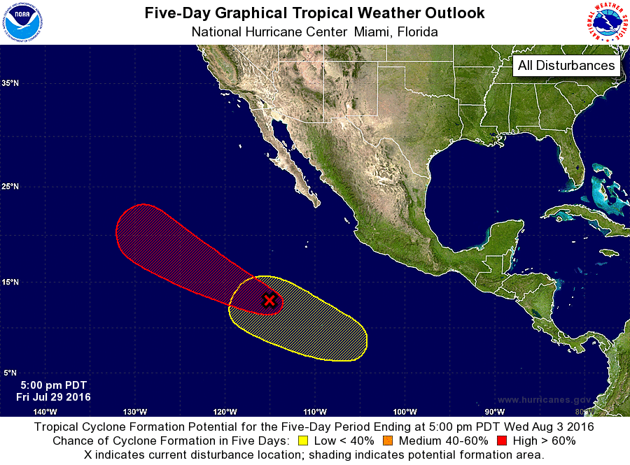
For the eastern North Pacific...east of 140 degrees west longitude:
1. Shower activity associated with a broad and elongated area of low
pressure located about 750 miles south-southwest of the southern tip
of the Baja California peninsula has changed little in organization
today. However, upper-level winds are expected to become more
conducive for development, and a tropical depression is likely to
form over the weekend or early next week while the low moves
west-northwestward at 10 to 15 mph.
* Formation chance through 48 hours...medium...50 percent
* Formation chance through 5 days...high...80 percent
2. An area of low pressure is expected to form in a couple of days
several hundred miles south of Mexico. Some development of this
system is possible by early next week while it moves
west-northwestward away from the coast of Mexico.
* Formation chance through 48 hours...low...near 0 percent
* Formation chance through 5 days...low...20 percent
Forecaster Stewart