ZCZC MIATWOEP ALL
TTAA00 KNHC DDHHMM
TROPICAL WEATHER OUTLOOK
NWS NATIONAL HURRICANE CENTER MIAMI FL
500 PM PDT THU JUL 14 2016
For the eastern North Pacific...east of 140 degrees west longitude:
The National Hurricane Center is issuing advisories on Tropical
Storm Celia, located about 1100 miles east of the Hawaiian
Islands, and on Hurricane Darby, located more than 700 miles
southwest of the southern tip of the Baja California peninsula.
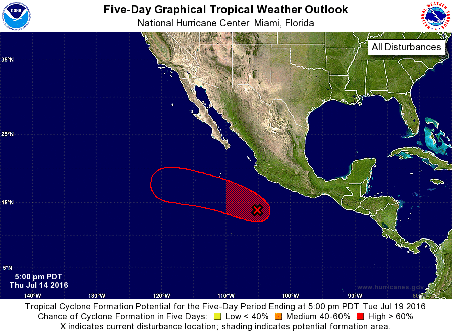
1. Satellite data indicate that the area of low pressure located
several hundred miles south of Manzanillo, Mexico, is becoming
better defined. Shower and thunderstorm activity has also been
increasing and becoming better organized, and a tropical depression
is likely to form later tonight or on Friday while the system moves
west-northwestward at 10 to 15 mph, away from the coast of Mexico.
* Formation chance through 48 hours...high...90 percent
* Formation chance through 5 days...high...90 percent
Forecaster Stewart