ZCZC MIATWOEP ALL
TTAA00 KNHC DDHHMM
TROPICAL WEATHER OUTLOOK
NWS NATIONAL HURRICANE CENTER MIAMI FL
500 PM PDT WED JUL 13 2016
For the eastern North Pacific...east of 140 degrees west longitude:
The National Hurricane Center is issuing advisories on Tropical
Storm Celia, located more than 1300 miles east of the Hawaiian
Islands, and on recently upgraded Hurricane Darby, located about
570 miles south-southwest of the southern tip of the Baja California
peninsula.
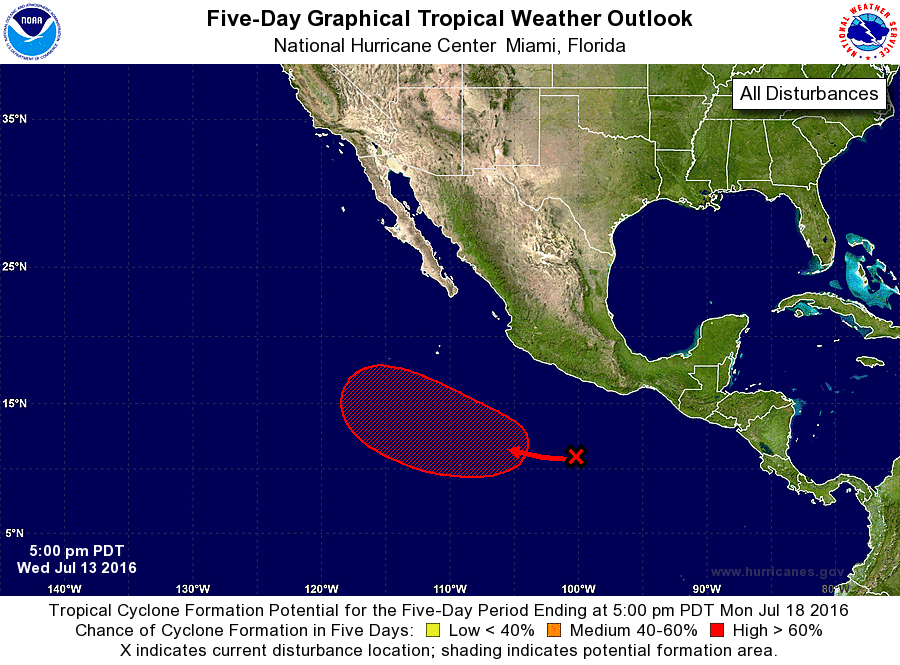
1. Cloudiness and showers associated with a tropical wave have
continued to increase several hundred miles south of Acapulco,
Mexico. An area of low pressure is expected to form during
the next day or so, and environmental conditions appear conducive
for the low to become a tropical depression by the weekend while
it moves westward to west-northwestward at 10 to 15 mph.
* Formation chance through 48 hours...medium...40 percent
* Formation chance through 5 days...high...90 percent
Forecaster Stewart