ZCZC MIATWOEP ALL
TTAA00 KNHC DDHHMM
TROPICAL WEATHER OUTLOOK
NWS NATIONAL HURRICANE CENTER MIAMI FL
500 PM PDT TUE JUL 12 2016
For the eastern North Pacific...east of 140 degrees west longitude:
The National Hurricane Center is issuing advisories on Hurricane
Celia, located more than 1000 miles west-southwest of the southern
tip of the Baja California peninsula, and on Tropical Storm Darby,
located several hundred miles west-southwest of Manzanillo, Mexico.
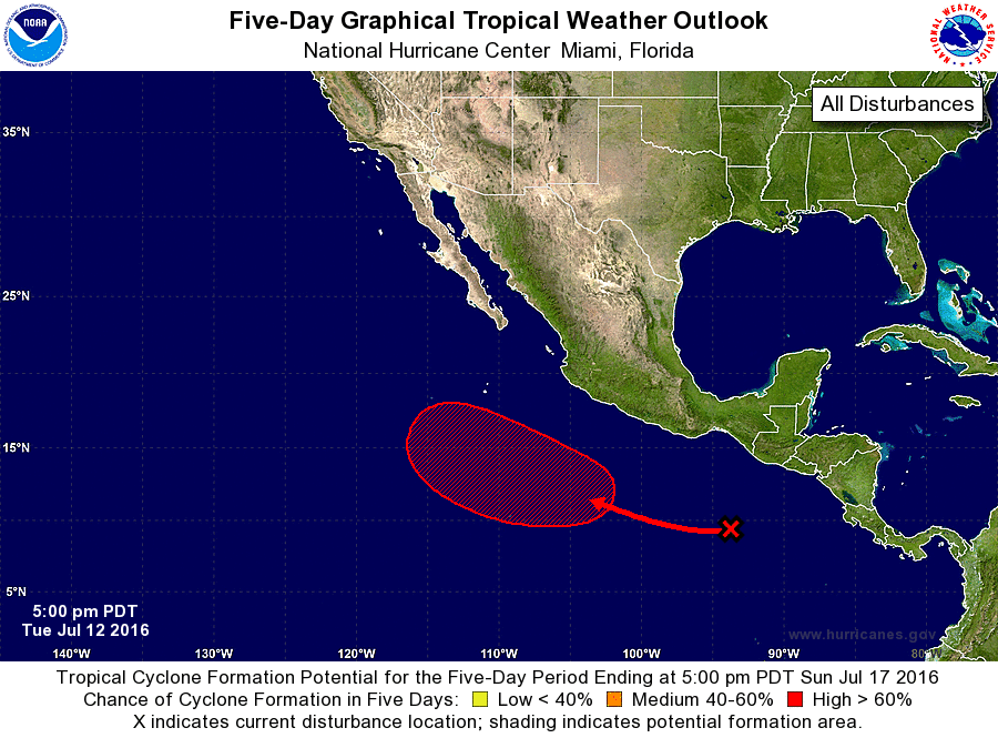
1. Disorganized shower and thunderstorm activity to the south and
southwest of the Gulf of Tehuantepec is associated with a tropical
wave. Environmental conditions are expected to be conducive for
this system to become a tropical depression over the weekend while
it moves westward to west-northwestward at 10 to 15 mph.
* Formation chance through 48 hours...low...near 0 percent
* Formation chance through 5 days...high...70 percent
Forecaster Pasch