ZCZC MIATWOEP ALL
TTAA00 KNHC DDHHMM
TROPICAL WEATHER OUTLOOK
NWS NATIONAL HURRICANE CENTER MIAMI FL
500 AM PDT SUN JUL 10 2016
For the eastern North Pacific...east of 140 degrees west longitude:
The National Hurricane Center is issuing advisories on Tropical
Storm Blas, located about 1300 miles east of the Big Island of
Hawaii, and on Tropical Storm Celia, located more than 800 miles
southwest of the southern tip of the Baja California peninsula.
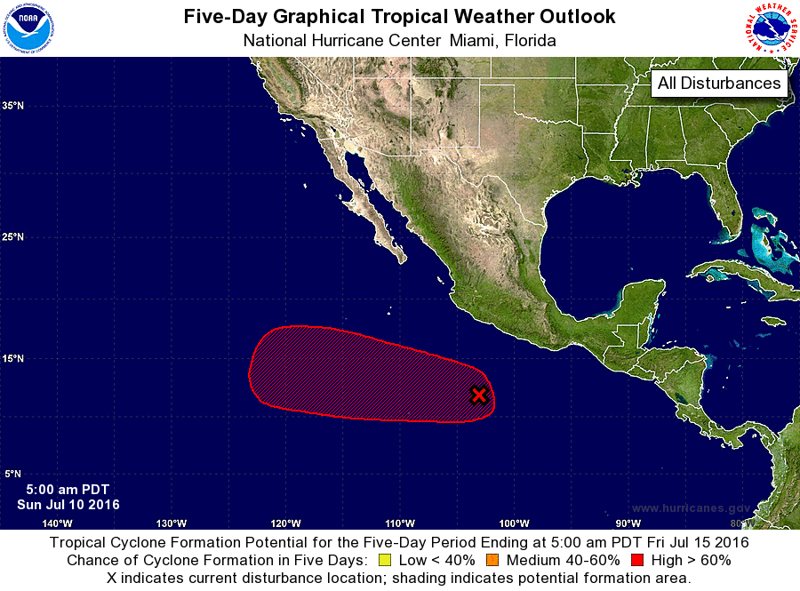
1. A broad area of low pressure located several hundred miles
south-southeast of Manzanillo, Mexico, continues to produce
disorganized shower and thunderstorm activity. However,
environmental conditions appear conducive for gradual development
of this system, and a tropical depression is likely to form by the
middle of this week while the low moves west-northwestward to
westward at about 10 mph, away from the coast of Mexico.
* Formation chance through 48 hours...medium...50 percent
* Formation chance through 5 days...high...80 percent
Forecaster Stewart