ZCZC MIATWOEP ALL
TTAA00 KNHC DDHHMM
TROPICAL WEATHER OUTLOOK
NWS NATIONAL HURRICANE CENTER MIAMI FL
1100 AM PDT WED JUL 6 2016
For the eastern North Pacific...east of 140 degrees west longitude:
The National Hurricane Center is issuing advisories on Hurricane
Blas, located about 1000 miles west-southwest of the southern tip
of the Baja California peninsula.
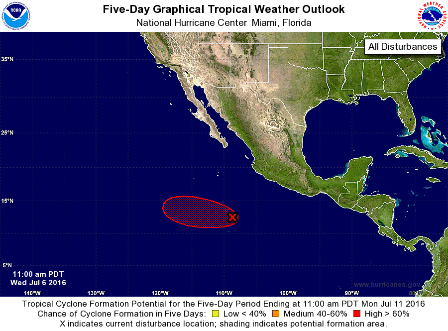
1. Showers and thunderstorms associated with a broad area of low
pressure located about 525 miles south-southwest of Manzanillo,
Mexico, continue to show some signs of organization. Environmental
conditions are conducive for additional development, and a tropical
depression is likely to form during the next day or so while the
system moves westward at about 10 mph.
* Formation chance through 48 hours...high...80 percent
* Formation chance through 5 days...high...90 percent
Forecaster Brown