ZCZC MIATWOEP ALL
TTAA00 KNHC DDHHMM
TROPICAL WEATHER OUTLOOK
NWS NATIONAL HURRICANE CENTER MIAMI FL
1100 PM PDT TUE JUL 5 2016
For the eastern North Pacific...east of 140 degrees west longitude:
The National Hurricane Center is issuing advisories on Hurricane
Blas, located about 1000 miles southwest of the southern tip of
the Baja California peninsula.
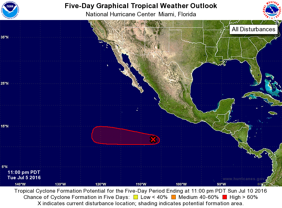
1. Shower and thunderstorm activity has increased since yesterday in
association with an area of low pressure located about 500 miles
south-southwest of Manzanillo, Mexico. Continued development of
this system is expected, and a tropical depression is likely to form
during the next few days while it moves westward at around 10 mph.
* Formation chance through 48 hours...medium...60 percent
* Formation chance through 5 days...high...90 percent
Forecaster Brennan