ZCZC MIATWOEP ALL
TTAA00 KNHC DDHHMM
TROPICAL WEATHER OUTLOOK
NWS NATIONAL HURRICANE CENTER MIAMI FL
500 AM PDT FRI JUN 17 2016
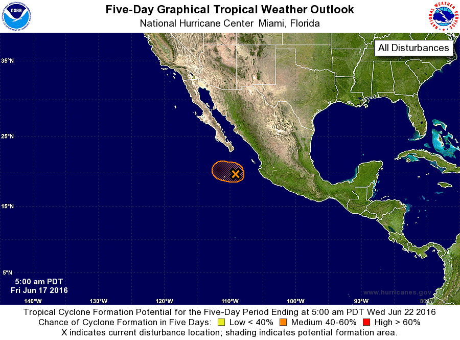
For the eastern North Pacific...east of 140 degrees west longitude:
1. Shower and thunderstorm activity has increased overnight in
association with a broad area of low pressure centered about 230
miles south-southeast of the southern tip of the Baja California
Peninsula. Although environmental conditions are only marginally
conducive for additional development, a tropical depression could
still form today while the low moves toward the west-northwest at
around 10 mph. By tonight environmental conditions are expected to
become unfavorable for tropical cyclone formation as the low moves
over cooler waters.
* Formation chance through 48 hours...medium...60 percent
* Formation chance through 5 days...medium...60 percent
Forecaster Brennan