ZCZC MIATWOEP ALL
TTAA00 KNHC DDHHMM
TROPICAL WEATHER OUTLOOK
NWS NATIONAL HURRICANE CENTER MIAMI FL
1100 PM PDT THU JUN 16 2016
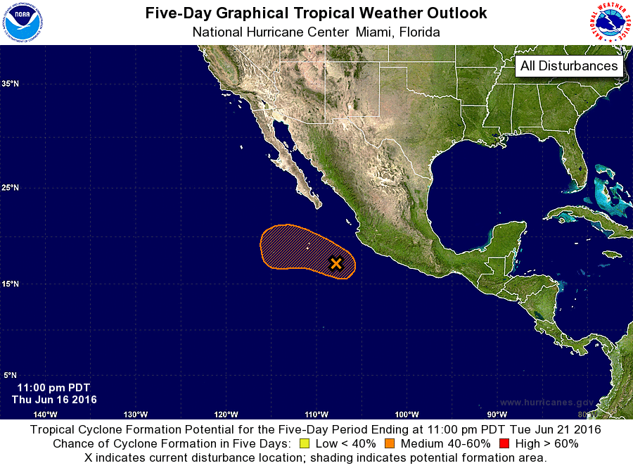
For the eastern North Pacific...east of 140 degrees west longitude:
1. A broad area of low pressure, centered about 275 miles southwest of
Manzanillo, Mexico, is producing a large area of cloudiness and
disorganized thunderstorm activity. Although environmental
conditions are only marginally conducive for development, a narrow
window of opportunity still exists tonight and Friday morning for a
tropical depression to form while the low moves toward the
west-northwest or northwest at around 10 mph. However, by Friday
night and over the weekend, environmental conditions will become
unfavorable for tropical cyclone formation.
* Formation chance through 48 hours...medium...60 percent
* Formation chance through 5 days...medium...60 percent
Forecaster Stewart