


NHC Graphical Outlook Archive
|
« Earliest Available ‹ Earlier Later › Latest Available » |
GIS Shapefiles |
| Eastern North Pacific | Atlantic |
|
Tropical Weather Outlook Text
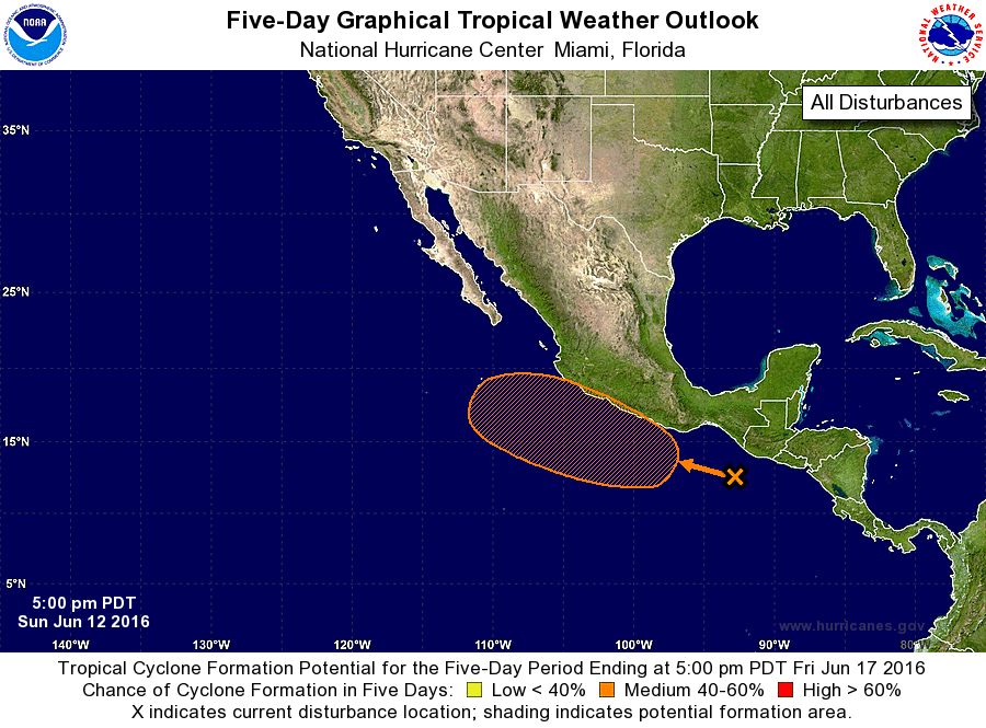
ZCZC MIATWOEP ALL
TTAA00 KNHC DDHHMM

TROPICAL WEATHER OUTLOOK
NWS NATIONAL HURRICANE CENTER MIAMI FL
500 PM PDT SUN JUN 12 2016

For the eastern North Pacific...east of 140 degrees west longitude:

1. An area of low pressure is expected to develop south of the coast of
southern Mexico in a couple of days in association with a tropical
wave that is currently located south of the Gulf of Tehuantepec.
Environmental conditions are expected to be conducive for gradual
development of this system, and a tropical depression could form
later this week while the disturbance moves westward or
west-northwestward.
* Formation chance through 48 hours...low...10 percent
* Formation chance through 5 days...medium...60 percent

Forecaster Brennan
List of Atlantic Outlooks (May 2023 - present)
List of East Pacific Outlooks (May 2023 - present)
List of Central Pacific Outlooks (May 2023 - present)
List of Atlantic Outlooks (July 2014 - April 2023)
List of East Pacific Outlooks (July 2014 - April 2023)
List of Central Pacific Outlooks (June 2019 - April 2023)
List of Atlantic Outlooks (June 2009 - June 2014)
List of East Pacific Outlooks (June 2009 - June 2014)