


NHC Graphical Outlook Archive
|
« Earliest Available ‹ Earlier Later › Latest Available » |
GIS Shapefiles |
| Eastern North Pacific | Atlantic |
|
Tropical Weather Outlook Text
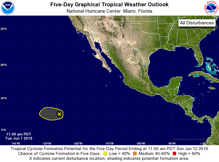
ZCZC MIATWOEP ALL
TTAA00 KNHC DDHHMM

TROPICAL WEATHER OUTLOOK
NWS NATIONAL HURRICANE CENTER MIAMI FL
1100 AM PDT TUE JUN 7 2016

For the eastern North Pacific...east of 140 degrees west longitude:

The National Hurricane Center is issuing advisories on Tropical
Depression One-E located just south of southeastern Mexico.

1. A low pressure system located about 1425 miles southwest of the
southern tip of the Baja California peninsula continues to produce
sporadic bursts of showers and thunderstorms, though these have
little organization.  Some development of this system is possible,
though environmental conditions do not appear to be conducive beyond
the next day or two.
* Formation chance through 48 hours...low...20 percent
* Formation chance through 5 days...low...20 percent

Forecaster Landsea
List of Atlantic Outlooks (May 2023 - present)
List of East Pacific Outlooks (May 2023 - present)
List of Central Pacific Outlooks (May 2023 - present)
List of Atlantic Outlooks (July 2014 - April 2023)
List of East Pacific Outlooks (July 2014 - April 2023)
List of Central Pacific Outlooks (June 2019 - April 2023)
List of Atlantic Outlooks (June 2009 - June 2014)
List of East Pacific Outlooks (June 2009 - June 2014)