


NHC Graphical Outlook Archive
|
« Earliest Available ‹ Earlier Later › Latest Available » |
GIS Shapefiles |
| Eastern North Pacific | Atlantic |
|
Tropical Weather Outlook Text
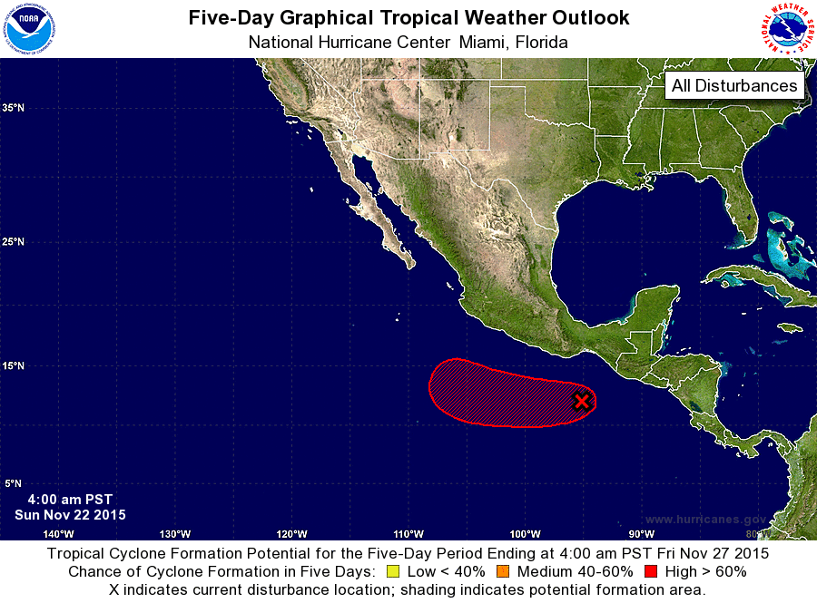
ZCZC MIATWOEP ALL
TTAA00 KNHC DDHHMM

TROPICAL WEATHER OUTLOOK
NWS NATIONAL HURRICANE CENTER MIAMI FL
400 AM PST SUN NOV 22 2015

For the eastern North Pacific...east of 140 degrees west longitude:

The National Hurricane Center is issuing advisories on Tropical
Depression Rick, located several hundred miles southwest of the
southern tip of the Baja California peninsula.

1. A broad area of low pressure located a couple of hundred miles south
of the Gulf of Tehuantepec is producing a large area of disorganized
cloudiness and thunderstorms. Environmental conditions are forecast
to become more conducive for development of this system, and a
tropical depression is expected to form south of the southern coast
of Mexico within the next couple of days while the disturbance moves
westward at 10 to 15 mph.
* Formation chance through 48 hours...high...70 percent
* Formation chance through 5 days...high...90 percent

Forecaster Brown
List of Atlantic Outlooks (May 2023 - present)
List of East Pacific Outlooks (May 2023 - present)
List of Central Pacific Outlooks (May 2023 - present)
List of Atlantic Outlooks (July 2014 - April 2023)
List of East Pacific Outlooks (July 2014 - April 2023)
List of Central Pacific Outlooks (June 2019 - April 2023)
List of Atlantic Outlooks (June 2009 - June 2014)
List of East Pacific Outlooks (June 2009 - June 2014)