


NHC Graphical Outlook Archive
|
« Earliest Available ‹ Earlier Later › Latest Available » |
GIS Shapefiles |
| Eastern North Pacific | Atlantic |
|
Tropical Weather Outlook Text
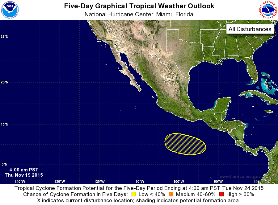
ZCZC MIATWOEP ALL
TTAA00 KNHC DDHHMM

TROPICAL WEATHER OUTLOOK
NWS NATIONAL HURRICANE CENTER MIAMI FL
400 AM PST THU NOV 19 2015

For the eastern North Pacific...east of 140 degrees west longitude:

The National Hurricane Center is issuing advisories on Tropical
Depression Twenty-One-E, located about 400 miles south-southwest
of Manzanillo, Mexico.

1. An area of low pressure is expected to form several hundred miles
south or southwest of the Gulf of Tehuantepec late this weekend or
early next week.  Environmental conditions are expected to be
conducive for gradual development of this system while it moves
westward to west-northwestward at 10 to 15 mph.
* Formation chance through 48 hours...low...near 0 percent
* Formation chance through 5 days...low...20 percent

Public Advisories on Tropical Depression Twenty-One-E are issued
under WMO header WTPZ31 KNHC and under AWIPS header MIATCPEP1.
Forecast/Advisories on Tropical Depression Twenty-One-E are issued
under WMO header WTPZ21 KNHC and under AWIPS header MIATCMEP1.

Forecaster Kimberlain
List of Atlantic Outlooks (May 2023 - present)
List of East Pacific Outlooks (May 2023 - present)
List of Central Pacific Outlooks (May 2023 - present)
List of Atlantic Outlooks (July 2014 - April 2023)
List of East Pacific Outlooks (July 2014 - April 2023)
List of Central Pacific Outlooks (June 2019 - April 2023)
List of Atlantic Outlooks (June 2009 - June 2014)
List of East Pacific Outlooks (June 2009 - June 2014)