


NHC Graphical Outlook Archive
|
« Earliest Available ‹ Earlier Later › Latest Available » |
GIS Shapefiles |
| Eastern North Pacific | Atlantic |
|
Tropical Weather Outlook Text
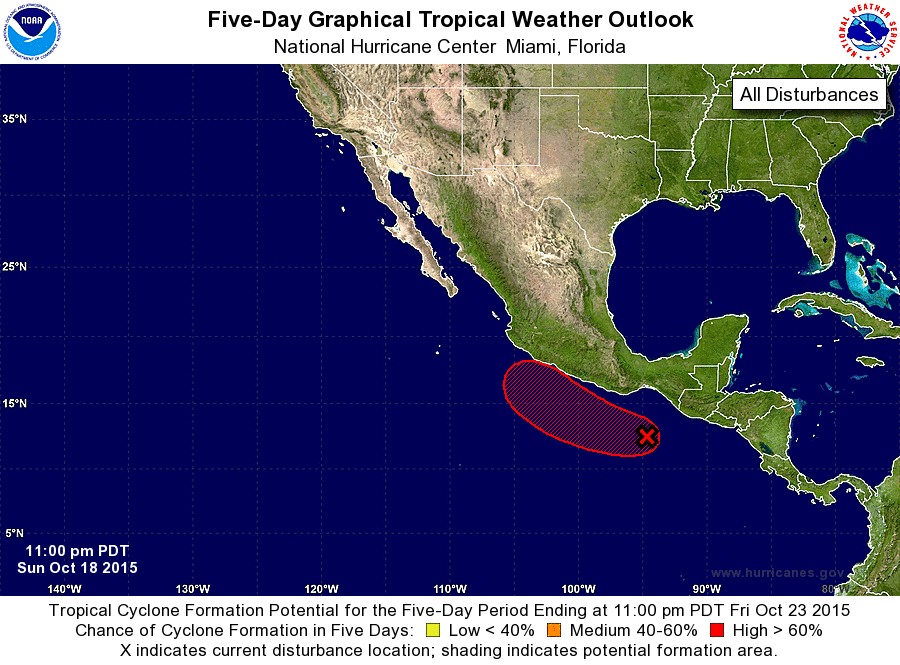
ZCZC MIATWOEP ALL
TTAA00 KNHC DDHHMM

TROPICAL WEATHER OUTLOOK
NWS NATIONAL HURRICANE CENTER MIAMI FL
1100 PM PDT SUN OCT 18 2015

For the eastern North Pacific...east of 140 degrees west longitude:

The National Hurricane Center is issuing advisories on Hurricane
Olaf, located a little less than 1500 miles east-southeast of
the Big Island of Hawaii.

1. Cloudiness and thunderstorms extending several hundred miles off the
coasts of southern Mexico and Guatemala are associated with a broad
area of low pressure, which is interacting with strong northerly
winds blowing over the Gulf of Tehuantepec.  Although some
development is possible during the next day or so, a tropical
depression is more likely to form around mid-week once the low
begins to move west-northwestward and then northwestward away from
the Gulf of Tehuantepec.  Interests along the southern and
southwestern coasts of Mexico should monitor the progress of this
system during the next few days.  Regardless of development, heavy
rains are possible over portions of southern Mexico, Guatemala, and
El Salvador during the next couple of days.
* Formation chance through 48 hours...medium...50 percent
* Formation chance through 5 days...high...80 percent

Forecaster Brown
List of Atlantic Outlooks (May 2023 - present)
List of East Pacific Outlooks (May 2023 - present)
List of Central Pacific Outlooks (May 2023 - present)
List of Atlantic Outlooks (July 2014 - April 2023)
List of East Pacific Outlooks (July 2014 - April 2023)
List of Central Pacific Outlooks (June 2019 - April 2023)
List of Atlantic Outlooks (June 2009 - June 2014)
List of East Pacific Outlooks (June 2009 - June 2014)