


NHC Graphical Outlook Archive
|
« Earliest Available ‹ Earlier Later › Latest Available » |
GIS Shapefiles |
| Eastern North Pacific | Atlantic |
|
Tropical Weather Outlook Text
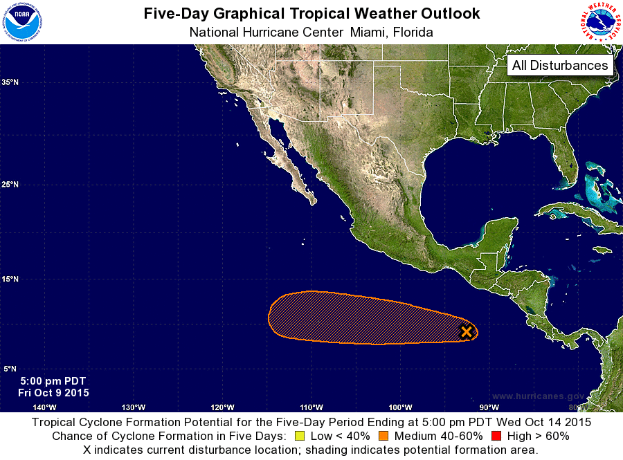
ZCZC MIATWOEP ALL
TTAA00 KNHC DDHHMM

TROPICAL WEATHER OUTLOOK
NWS NATIONAL HURRICANE CENTER MIAMI FL
500 PM PDT FRI OCT 9 2015

For the eastern North Pacific...east of 140 degrees west longitude:

The National Hurricane Center is issuing advisories on Tropical
Depression Eighteen-E, located well to the east-southeast of the
Hawaiian Islands.

1. Shower and thunderstorm activity has increased since yesterday in
association with a broad area of low pressure located about 500
miles south-southeast of the Gulf of Tehuantepec. Environmental
conditions are expected to be conducive for additional gradual
development of this system during the next several days while it
moves westward at 10 to 15 mph.
* Formation chance through 48 hours...low...30 percent
* Formation chance through 5 days...medium...60 percent

Public Advisories on Tropical Depression Eighteen-E are issued
under WMO header WTPZ33 KNHC and under AWIPS header MIATCPEP3.
Forecast/Advisories on Tropical Depression Eighteen-E are issued
under WMO header WTPZ23 KNHC and under AWIPS header MIATCMEP3.

Forecaster Brennan
List of Atlantic Outlooks (May 2023 - present)
List of East Pacific Outlooks (May 2023 - present)
List of Central Pacific Outlooks (May 2023 - present)
List of Atlantic Outlooks (July 2014 - April 2023)
List of East Pacific Outlooks (July 2014 - April 2023)
List of Central Pacific Outlooks (June 2019 - April 2023)
List of Atlantic Outlooks (June 2009 - June 2014)
List of East Pacific Outlooks (June 2009 - June 2014)