


NHC Graphical Outlook Archive
|
« Earliest Available ‹ Earlier Later › Latest Available » |
GIS Shapefiles |
| Eastern North Pacific | Atlantic |
|
Tropical Weather Outlook Text
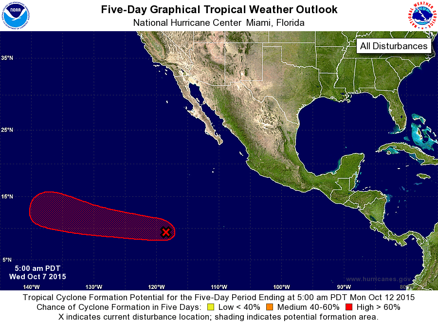
ZCZC MIATWOEP ALL
TTAA00 KNHC DDHHMM

TROPICAL WEATHER OUTLOOK
NWS NATIONAL HURRICANE CENTER MIAMI FL
500 AM PDT WED OCT 7 2015

For the eastern North Pacific...east of 140 degrees west longitude:

1. Showers and thunderstorms associated with a tropical wave located
about 1200 miles south-southwest of the southern tip of the Baja
California peninsula have become better organized since yesterday.
Environmental conditions are expected to be conducive for
development, and a tropical depression is likely to form by the
weekend while the system moves west-northwestward at about 15 mph.
* Formation chance through 48 hours...medium...40 percent
* Formation chance through 5 days...high...70 percent

Forecaster Blake
List of Atlantic Outlooks (May 2023 - present)
List of East Pacific Outlooks (May 2023 - present)
List of Central Pacific Outlooks (May 2023 - present)
List of Atlantic Outlooks (July 2014 - April 2023)
List of East Pacific Outlooks (July 2014 - April 2023)
List of Central Pacific Outlooks (June 2019 - April 2023)
List of Atlantic Outlooks (June 2009 - June 2014)
List of East Pacific Outlooks (June 2009 - June 2014)