


NHC Graphical Outlook Archive
|
« Earliest Available ‹ Earlier Later › Latest Available » |
GIS Shapefiles |
| Eastern North Pacific | Atlantic |
|
Tropical Weather Outlook Text
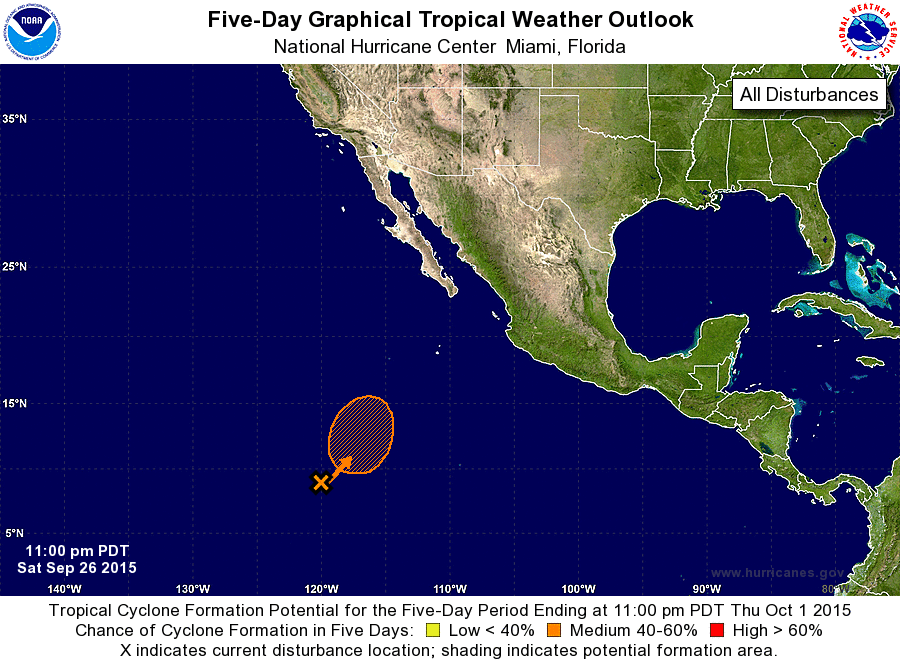
ZCZC MIATWOEP ALL
TTAA00 KNHC DDHHMM

TROPICAL WEATHER OUTLOOK
NWS NATIONAL HURRICANE CENTER MIAMI FL
1100 PM PDT SAT SEP 26 2015

For the eastern North Pacific...east of 140 degrees west longitude:

The National Hurricane Center is issuing advisories on Tropical
Storm Marty, located a few hundred miles southwest of Acapulco,
Mexico.

1. A broad area of low pressure is expected to form over the next
couple of days from a surface trough located about 1000 miles
southwest of the southern tip of the Baja California peninsula.
Environmental conditions appear conducive for development of this
system by the middle of the week while it moves slowly northward or
northeastward.
* Formation chance through 48 hours...low...10 percent
* Formation chance through 5 days...medium...40 percent

Public Advisories on Marty are issued under WMO header WTPZ32 KNHC
and under AWIPS header MIATCPEP2.  Forecast/Advisories on Marty are
issued under WMO header WTPZ22 KNHC and under AWIPS header
MIATCMEP2.

Forecaster Berg
List of Atlantic Outlooks (May 2023 - present)
List of East Pacific Outlooks (May 2023 - present)
List of Central Pacific Outlooks (May 2023 - present)
List of Atlantic Outlooks (July 2014 - April 2023)
List of East Pacific Outlooks (July 2014 - April 2023)
List of Central Pacific Outlooks (June 2019 - April 2023)
List of Atlantic Outlooks (June 2009 - June 2014)
List of East Pacific Outlooks (June 2009 - June 2014)