


NHC Graphical Outlook Archive
|
« Earliest Available ‹ Earlier Later › Latest Available » |
GIS Shapefiles |
| Eastern North Pacific | Atlantic |
|
Tropical Weather Outlook Text
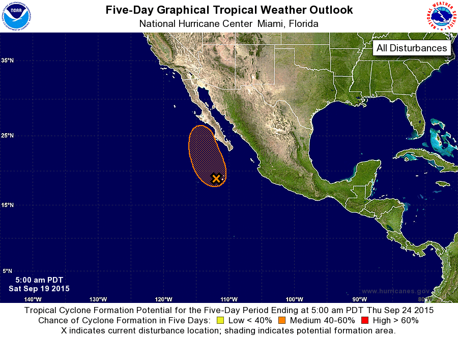
ZCZC MIATWOEP ALL
TTAA00 KNHC DDHHMM

TROPICAL WEATHER OUTLOOK
NWS NATIONAL HURRICANE CENTER MIAMI FL
500 AM PDT SAT SEP 19 2015

For the eastern North Pacific...east of 140 degrees west longitude:

1. Showers and thunderstorms have become a little more concentrated
near an area of low pressure located about 300 miles south-
southwest of the southern tip of the Baja California peninsula.
However, the low does not appear to have a well-defined center
of circulation at this time.  Environmental conditions are conducive
for development during the next day or so while this system moves
north-northwestward at around 10 mph.  After that time, colder water
and strong upper-level winds should prevent tropical cyclone
formation.  Regardless of development, moisture from this system is
expected to produce heavy rains across portions of the Baja
California peninsula and northwestern mainland Mexico through early
next week, possibly resulting in life-threatening flash floods and
mudslides.
* Formation chance through 48 hours...medium...50 percent
* Formation chance through 5 days...medium...50 percent

Forecaster Berg
List of Atlantic Outlooks (May 2023 - present)
List of East Pacific Outlooks (May 2023 - present)
List of Central Pacific Outlooks (May 2023 - present)
List of Atlantic Outlooks (July 2014 - April 2023)
List of East Pacific Outlooks (July 2014 - April 2023)
List of Central Pacific Outlooks (June 2019 - April 2023)
List of Atlantic Outlooks (June 2009 - June 2014)
List of East Pacific Outlooks (June 2009 - June 2014)