


NHC Graphical Outlook Archive
|
« Earliest Available ‹ Earlier Later › Latest Available » |
GIS Shapefiles |
| Eastern North Pacific | Atlantic |
|
Tropical Weather Outlook Text
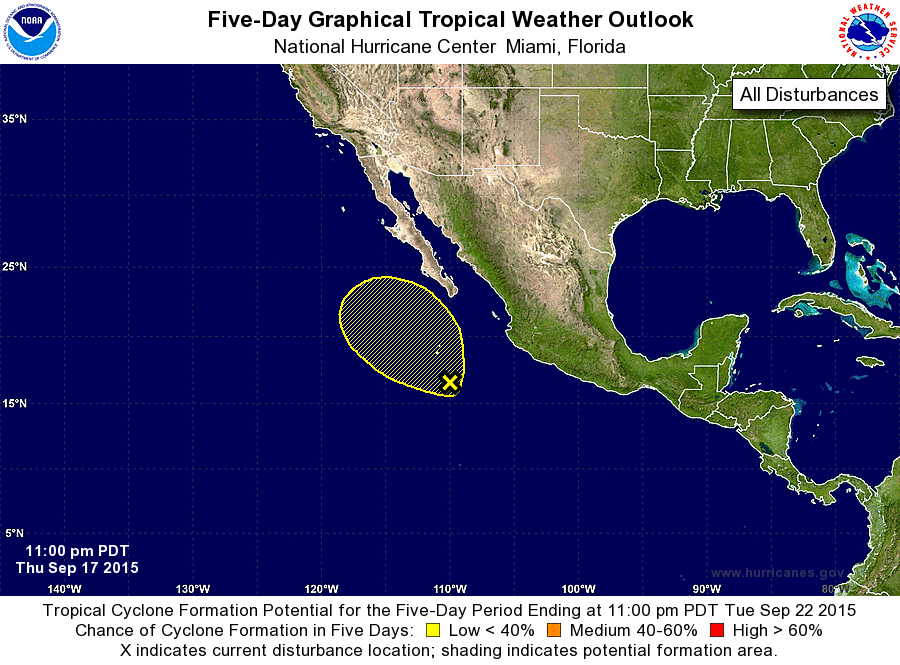
ZCZC MIATWOEP ALL
TTAA00 KNHC DDHHMM

TROPICAL WEATHER OUTLOOK
NWS NATIONAL HURRICANE CENTER MIAMI FL
1100 PM PDT THU SEP 17 2015

For the eastern North Pacific...east of 140 degrees west longitude:

1. Shower activity associated with a large and elongated area of low
pressure located several hundred miles south of the southern tip of
the Baja California peninsula has changed little in organization
during the past 24 hours.  Some gradual development of this system
is possible through this weekend while it moves slowly northwestward
to north-northwestward. After that time, development is less likely
as the system moves over colder water.
* Formation chance through 48 hours...low...20 percent
* Formation chance through 5 days...low...30 percent

Forecaster Beven
List of Atlantic Outlooks (May 2023 - present)
List of East Pacific Outlooks (May 2023 - present)
List of Central Pacific Outlooks (May 2023 - present)
List of Atlantic Outlooks (July 2014 - April 2023)
List of East Pacific Outlooks (July 2014 - April 2023)
List of Central Pacific Outlooks (June 2019 - April 2023)
List of Atlantic Outlooks (June 2009 - June 2014)
List of East Pacific Outlooks (June 2009 - June 2014)