


NHC Graphical Outlook Archive
|
« Earliest Available ‹ Earlier Later › Latest Available » |
GIS Shapefiles |
| Eastern North Pacific | Atlantic |
|
Tropical Weather Outlook Text
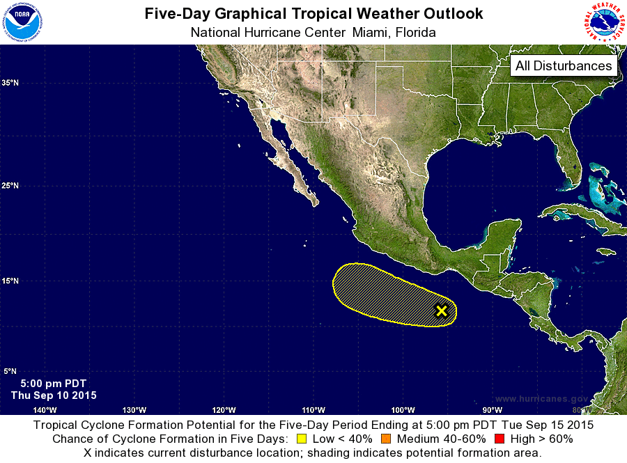
ZCZC MIATWOEP ALL
TTAA00 KNHC DDHHMM

TROPICAL WEATHER OUTLOOK
NWS NATIONAL HURRICANE CENTER MIAMI FL
500 PM PDT THU SEP 10 2015

For the eastern North Pacific...east of 140 degrees west longitude:

The National Hurricane Center has issued the final advisory on
Post-Tropical Cyclone Linda, located a couple of hundred miles
west-southwest of Punta Eugenia, Mexico.

1. Showers and thunderstorms remain disorganized near a broad area of
low pressure located a couple of hundred miles south of the Gulf of
Tehuantepec.  Environmental conditions are only marginally
conducive for development, and this system's close proximity to two
other areas of disturbed weather will likely limit its formation
potential during the next few days.  The system is expected to move
generally west-northwestward at about 10 mph.
* Formation chance through 48 hours...low...near 0 percent
* Formation chance through 5 days...low...30 percent

Forecaster Berg
List of Atlantic Outlooks (May 2023 - present)
List of East Pacific Outlooks (May 2023 - present)
List of Central Pacific Outlooks (May 2023 - present)
List of Atlantic Outlooks (July 2014 - April 2023)
List of East Pacific Outlooks (July 2014 - April 2023)
List of Central Pacific Outlooks (June 2019 - April 2023)
List of Atlantic Outlooks (June 2009 - June 2014)
List of East Pacific Outlooks (June 2009 - June 2014)