


NHC Graphical Outlook Archive
|
« Earliest Available ‹ Earlier Later › Latest Available » |
GIS Shapefiles |
| Eastern North Pacific | Atlantic |
|
Tropical Weather Outlook Text
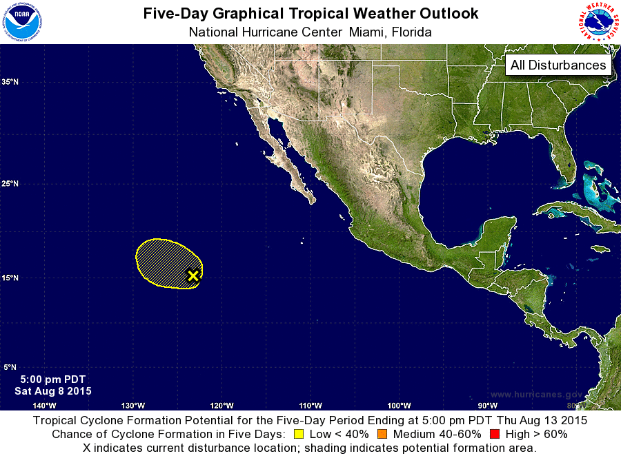
ZCZC MIATWOEP ALL
TTAA00 KNHC DDHHMM

TROPICAL WEATHER OUTLOOK
NWS NATIONAL HURRICANE CENTER MIAMI FL
500 PM PDT SAT AUG 8 2015

For the eastern North Pacific...east of 140 degrees west longitude:

1. Shower activity associated with a broad trough of low pressure
located about 1000 miles west-southwest of the southern tip of the
Baja California peninsula shows some signs of organization.  Some
development of this system is still possible during the next
day or two, but afterwards drier air and unfavorable upper-level
winds are expected to inhibit development.
* Formation chance through 48 hours...low...20 percent
* Formation chance through 5 days...low...20 percent

Forecaster Pasch
List of Atlantic Outlooks (May 2023 - present)
List of East Pacific Outlooks (May 2023 - present)
List of Central Pacific Outlooks (May 2023 - present)
List of Atlantic Outlooks (July 2014 - April 2023)
List of East Pacific Outlooks (July 2014 - April 2023)
List of Central Pacific Outlooks (June 2019 - April 2023)
List of Atlantic Outlooks (June 2009 - June 2014)
List of East Pacific Outlooks (June 2009 - June 2014)