


NHC Graphical Outlook Archive
|
« Earliest Available ‹ Earlier Later › Latest Available » |
GIS Shapefiles |
| Eastern North Pacific | Atlantic |
|
Tropical Weather Outlook Text
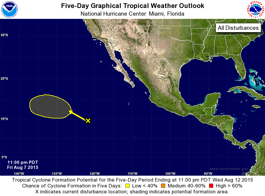
ZCZC MIATWOEP ALL
TTAA00 KNHC DDHHMM

TROPICAL WEATHER OUTLOOK
NWS NATIONAL HURRICANE CENTER MIAMI FL
1100 PM PDT FRI AUG 7 2015

For the eastern North Pacific...east of 140 degrees west longitude:

The National Hurricane Center has issued its last advisory on
Hurricane Hilda, located well to the east-southeast of the Hawaiian
Islands.  Future advisories on Hilda will be issued by the Central
Pacific Hurricane Center in Honolulu, Hawaii.

1. A broad trough of low pressure located about 1000 miles southwest of
the southern tip of the Baja California peninsula continues to
produce disorganized shower and thunderstorm activity.  Although
some gradual development is possible through early next week while
it moves generally northwestward, the system could move over cooler
waters before developing into a tropical cyclone.
* Formation chance through 48 hours...low...near 0 percent
* Formation chance through 5 days...low...30 percent

Forecaster Pasch
List of Atlantic Outlooks (May 2023 - present)
List of East Pacific Outlooks (May 2023 - present)
List of Central Pacific Outlooks (May 2023 - present)
List of Atlantic Outlooks (July 2014 - April 2023)
List of East Pacific Outlooks (July 2014 - April 2023)
List of Central Pacific Outlooks (June 2019 - April 2023)
List of Atlantic Outlooks (June 2009 - June 2014)
List of East Pacific Outlooks (June 2009 - June 2014)