


NHC Graphical Outlook Archive
|
« Earliest Available ‹ Earlier Later › Latest Available » |
GIS Shapefiles |
| Eastern North Pacific | Atlantic |
|
Tropical Weather Outlook Text
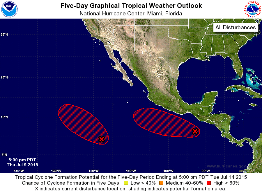
ZCZC MIATWOEP ALL
TTAA00 KNHC DDHHMM

TROPICAL WEATHER OUTLOOK
NWS NATIONAL HURRICANE CENTER MIAMI FL
500 PM PDT THU JUL 9 2015

For the eastern North Pacific...east of 140 degrees west longitude:

1. Showers and thunderstorms associated with a tropical wave and a
broad low pressure area centered about 1150 miles south-southwest of
the southern tip of Baja California Sur have increased over the last
24 hours.  Continued development is anticipated through the weekend,
and this system will likely become a tropical depression by early
next week while it moves west-northwestward or northwestward.
* Formation chance through 48 hours...low...40 percent
* Formation chance through 5 days...high...80 percent

2. Disorganized showers and thunderstorms located south of Guatemala
and southeastern Mexico are associated with a tropical wave and a
weak area of low pressure. Conditions are expected to be conducive
for gradual development over the next several days, and this system
will likely become a tropical depression by early next week while it
moves west-northwestward.
* Formation chance through 48 hours...low...20 percent
* Formation chance through 5 days...high...80 percent

Forecaster Beven
List of Atlantic Outlooks (May 2023 - present)
List of East Pacific Outlooks (May 2023 - present)
List of Central Pacific Outlooks (May 2023 - present)
List of Atlantic Outlooks (July 2014 - April 2023)
List of East Pacific Outlooks (July 2014 - April 2023)
List of Central Pacific Outlooks (June 2019 - April 2023)
List of Atlantic Outlooks (June 2009 - June 2014)
List of East Pacific Outlooks (June 2009 - June 2014)