


NHC Graphical Outlook Archive
|
« Earliest Available ‹ Earlier Later › Latest Available » |
GIS Shapefiles |
| Eastern Pacific | Atlantic |
|
Tropical Weather Outlook Text
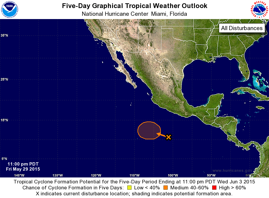
ZCZC MIATWOEP ALL
TTAA00 KNHC DDHHMM

TROPICAL WEATHER OUTLOOK
NWS NATIONAL HURRICANE CENTER MIAMI FL
1100 PM PDT FRI MAY 29 2015

For the eastern North Pacific...east of 140 degrees west longitude:

The National Hurricane Center is issuing advisories on Hurricane
Andres, located about 750 miles south-southwest of the southern tip
of the Baja California peninsula.

1. A weak low pressure system located several hundred miles south-
southwest of Acapulco, Mexico, is accompanied by disorganized
cloudiness and showers.  Strong upper-level winds associated with
Hurricane Andres should inhibit tropical cyclone formation during
the next few days while the system moves west-northwestward at about
5 mph.  However, these winds are expected to weaken on Monday, and
development of this system appears likely by the middle of next
week.
* Formation chance through 48 hours...low...10 percent
* Formation chance through 5 days...medium...60 percent

Forecaster Berg
List of Atlantic Outlooks (May 2023 - present)
List of East Pacific Outlooks (May 2023 - present)
List of Central Pacific Outlooks (May 2023 - present)
List of Atlantic Outlooks (July 2014 - April 2023)
List of East Pacific Outlooks (July 2014 - April 2023)
List of Central Pacific Outlooks (June 2019 - April 2023)
List of Atlantic Outlooks (June 2009 - June 2014)
List of East Pacific Outlooks (June 2009 - June 2014)