


NHC Graphical Outlook Archive
|
« Earliest Available ‹ Earlier Later › Latest Available » |
| Eastern Pacific | Atlantic |
|
|
(mouse over shaded areas for details; click on shaded areas or disturbance numbers to switch views) |
Tropical Weather Outlook Text
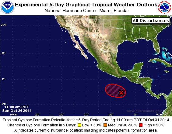
TROPICAL WEATHER OUTLOOK
NWS NATIONAL HURRICANE CENTER MIAMI FL
1100 AM PDT SUN OCT 26 2014

For the eastern North Pacific...east of 140 degrees west longitude:

1. A broad area of low pressure centered a few hundred miles south of
the Gulf of Tehuantepec continues to produce disorganized shower
and thunderstorm activity.  Dry air is currently inhibiting
development, but environmental conditions are forecast to become
more conducive for tropical cyclone formation later this week while
the system drifts toward the west-northwest.
* Formation chance through 48 hours...medium...30 percent.
* Formation chance through 5 days...high...80 percent.

Forecaster Berg
List of Atlantic Outlooks (May 2023 - present)
List of East Pacific Outlooks (May 2023 - present)
List of Central Pacific Outlooks (May 2023 - present)
List of Atlantic Outlooks (July 2014 - April 2023)
List of East Pacific Outlooks (July 2014 - April 2023)
List of Central Pacific Outlooks (June 2019 - April 2023)
List of Atlantic Outlooks (June 2009 - June 2014)
List of East Pacific Outlooks (June 2009 - June 2014)