


NHC Graphical Outlook Archive
|
« Earliest Available ‹ Earlier Later › Latest Available » |
| Eastern Pacific | Atlantic |
|
|
(mouse over shaded areas for details; click on shaded areas or disturbance numbers to switch views) |
Tropical Weather Outlook Text
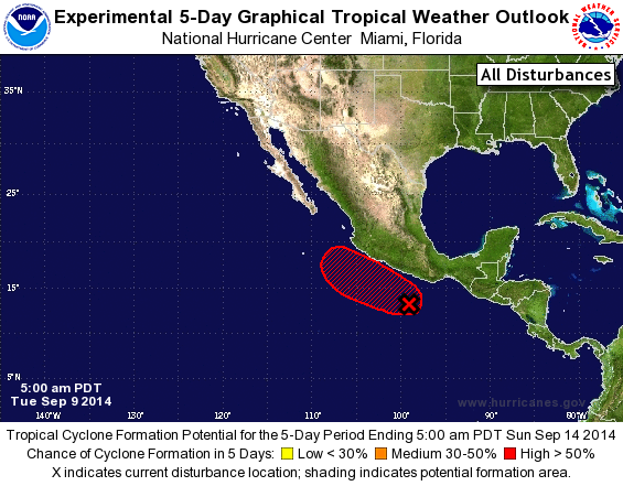
TROPICAL WEATHER OUTLOOK
NWS NATIONAL HURRICANE CENTER MIAMI FL
500 AM PDT TUE SEP 9 2014

For the eastern North Pacific...east of 140 degrees west longitude:

1. An area of low pressure located a couple of hundred miles south of
Acapulco, Mexico has changed little in organization overnight.
Environmental conditions are expected to be conducive for
development, and the low is likely to become a tropical depression
in the next couple of days while it moves slowly northwestward just
off the southwestern coast of Mexico.
* Formation chance through 48 hours...high...60 percent.
* Formation chance through 5 days...high...80 percent.

Forecaster Cangialosi
List of Atlantic Outlooks (May 2023 - present)
List of East Pacific Outlooks (May 2023 - present)
List of Central Pacific Outlooks (May 2023 - present)
List of Atlantic Outlooks (July 2014 - April 2023)
List of East Pacific Outlooks (July 2014 - April 2023)
List of Central Pacific Outlooks (June 2019 - April 2023)
List of Atlantic Outlooks (June 2009 - June 2014)
List of East Pacific Outlooks (June 2009 - June 2014)