ZCZC HFOTWOCP ALL
TTAA00 PHFO DDHHMM
Tropical Weather Outlook
NWS Central Pacific Hurricane Center Honolulu HI
800 AM HST Sat Nov 26 2022
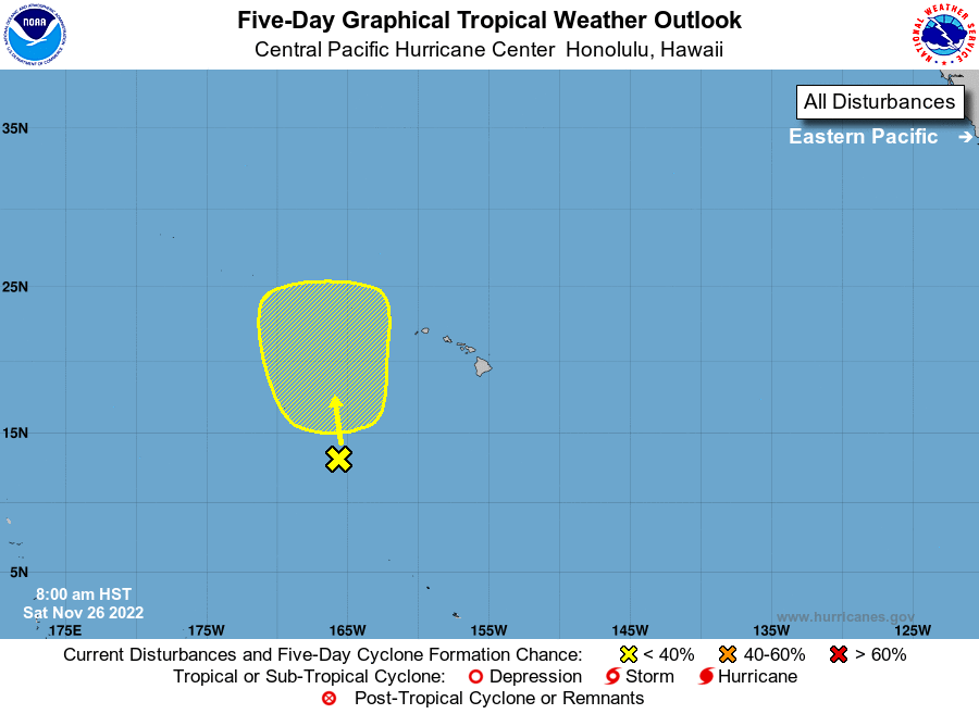
For the central North Pacific...between 140W and 180W:
1. An elongated trough of low pressure about 600 miles southwest of
the Hawaiian Islands is producing disorganized showers and
thunderstorms. An area of low pressure is expected to develop
along the trough over the next couple of days, with some slow
development possible early next week as it moves slowly toward the
north.
* Formation chance through 48 hours...low...near 0 percent
* Formation chance through 5 days...low...20 percent
Elsewhere, no tropical cyclones are expected during the next 5 days.
The central North Pacific hurricane season officially ends on
November 30. The final Tropical Weather Outlook of the season will
be issued at 8 PM on November 30. Routine issuance of the Tropical
Weather Outlook will resume on June 1, 2023. During the off-season,
Tropical Weather Outlooks will be issued if conditions warrant.
Forecaster TS