ZCZC HFOTWOCP ALL
TTAA00 PHFO DDHHMM
Tropical Weather Outlook
NWS Central Pacific Hurricane Center Honolulu HI
800 PM HST Sun Jul 25 2021
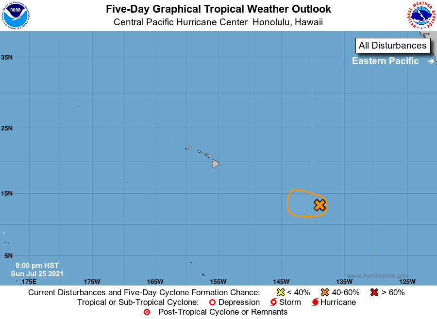
For the central North Pacific...between 140W and 180W:
1. The National Hurricane Center in Miami, Florida, is monitoring an
area of low pressure located about 1100 miles east-southeast of
Hilo, Hawaii, as it continues to move westward at about 15 mph.
Shower and thunderstorm activity remains disorganized, and
environmental conditions are gradually becoming less conducive for
additional development to occur. However, an increase in the
organization of the shower activity would result in the formation
of a tropical depression Monday. The low is forecast to move into
the Central Pacific basin by Monday morning, and by Tuesday
conditions are expected to become unfavorable for further
development.
* Formation chance through 48 hours...medium...60 percent.
* Formation chance through 5 days...medium...60 percent.
Elsewhere, no tropical cyclones are expected during the next 5
days.
Forecaster Kinel