ZCZC HFOTWOCP ALL
TTAA00 PHFO DDHHMM
Tropical Weather Outlook
NWS Central Pacific Hurricane Center Honolulu HI
200 PM HST Sun Jul 25 2021
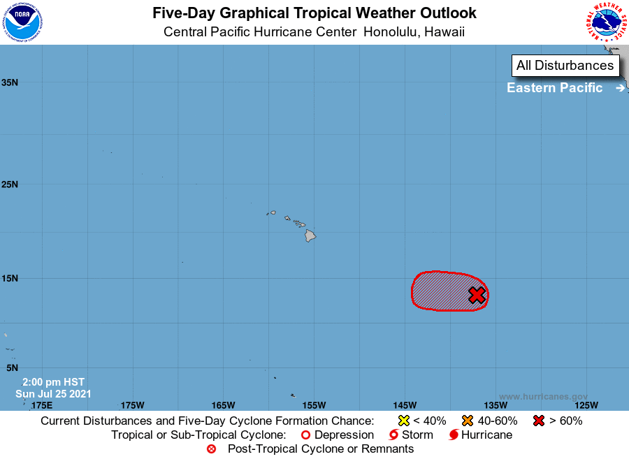
For the central North Pacific...between 140W and 180W:
1. The National Hurricane Center in Miami, Florida is monitoring an
area of low pressure located about 1200 miles east-southeast of
Hilo, Hawaii as it continues to move westward at about 15 mph.
Showers and thunderstorms associated with the system have persisted
for much of the day, but they remain displaced to the northwest and
north of the circulation center. Environmental conditions are
expected to remain conducive for some additional development during
the next day or so, and only a slight increase in the organization
of the system would result in the development of a tropical
depression. The low is forecast to move into the Central Pacific
basin on Monday morning, and on Tuesday conditions are expected to
become unfavorable for further development.
* Formation chance through 48 hours...high...70 percent.
* Formation chance through 5 days...high...70 percent.
Elsewhere, no tropical cyclones are expected during the next 5
days.
Forecaster TS