ZCZC HFOTWOCP ALL
TTAA00 PHFO DDHHMM
Tropical Weather Outlook
NWS Central Pacific Hurricane Center Honolulu HI
800 AM HST Sun Jul 25 2021
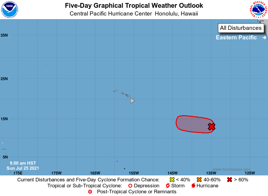
For the central North Pacific...between 140W and 180W:
1. The National Hurricane Center in Miami, Florida is monitoring
a low pressure system located around 1300 miles east-southeast of
Hilo, Hawaii. Recent satellite and microwave imagery indicate that
this area continues to show signs of organization. Environmental
conditions remain conducive for further development, and a tropical
depression is likely to form within the next day or so while the
system moves westward at 10 to 15 mph. By Tuesday night, conditions
are expected to become unfavorable for further development of this
system. Note that this system may cross into the Central Pacific
Hurricane Center's area of responsibility as early as Monday
morning.
* Formation chance through 48 hours...high...70 percent.
* Formation chance through 5 days...high...70 percent.
Elsewhere, no tropical cyclones are expected during the next 5
days.
Forecaster TS