ZCZC HFOTWOCP ALL
TTAA00 PHFO DDHHMM
Tropical Weather Outlook
NWS Central Pacific Hurricane Center Honolulu HI
200 AM HST Sun Jul 25 2021
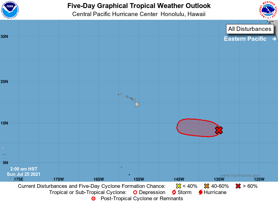
For the central North Pacific...between 140W and 180W:
1. The National Hurricane Center in Miami, Florida is monitoring
a low pressure system located slightly more than 1400 miles
east-southeast of Hilo, Hawaii, Satellite imagery indicates that
this system is showing signs of better organization this morning,
with increased shower and thunderstorm activity mainly to the
north of its center. Environmental conditions are expected to be
conducive for further development, and a tropical depression is
likely to form within the next day or so while the system moves
westward at 10 to 15 mph. By Tuesday, cooler waters and
unfavorable upper-level winds will likely limit any further
development of this system. Note that this system may cross into
the Central Pacific Hurricane Center's area of responsibility as
early as Monday morning.
* Formation chance through 48 hours...high...70 percent.
* Formation chance through 5 days...high...70 percent.
Elsewhere, no tropical cyclones are expected during the next 5
days.
Forecaster Houston